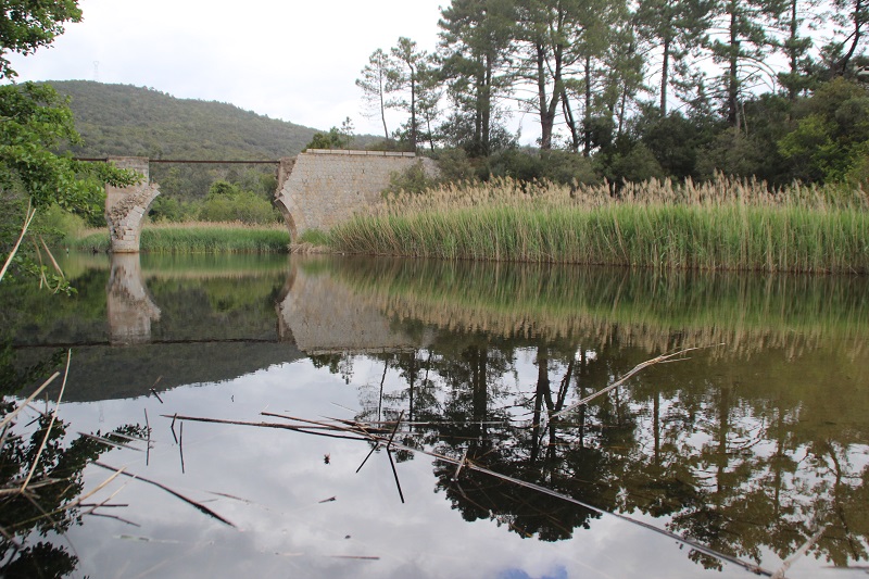
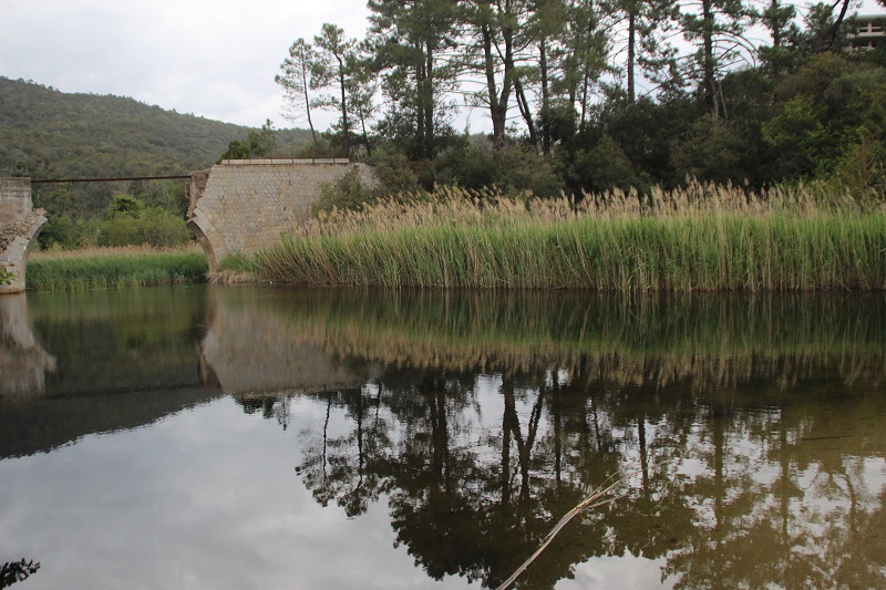
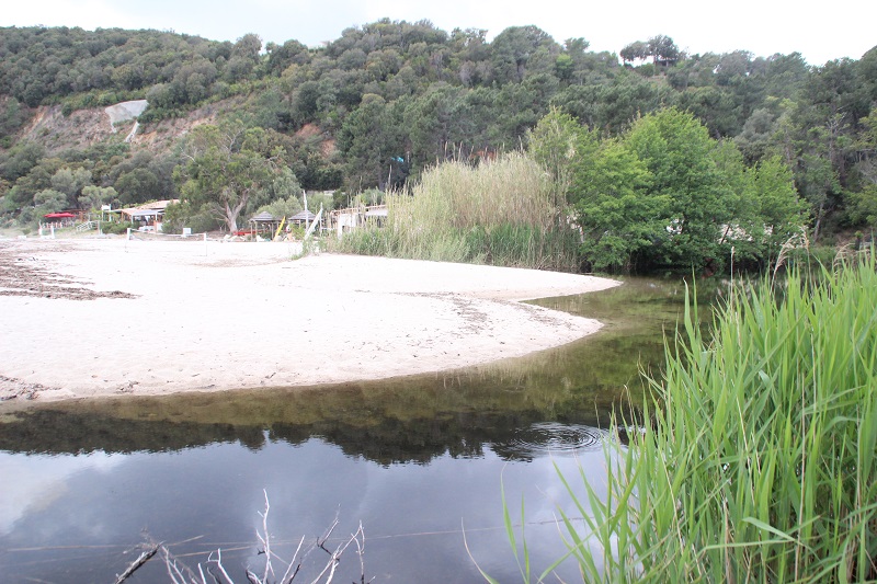
FR831COR106 - Embouchure de Cannella
Wetland data
Basic information
| Wetland location: |
Marine / Coastal |
| Wetland type: |
Natural |
| Wetland area: |
2.2 Ha |
| Hydrological interaction: |
- |
| Water salinity: |
Brackish (0.5 - 18.0 g/l) |
| Type of fresh water input: |
Torrent / Stream - Unconfined aquifer |
| Surface water runoff |
Outflow from lakeshore or river |
| Open water area (%): |
76 - 95 |
| Hydroperiod: |
Permanent |
Geographic information
| Region: |
Corsica |
| Sub region: |
Sartène |
| Island: |
Corsica |
| Municipality: |
Sari-Solenzara |
| Longitude: |
9.394870 East |
| Latitude: |
41.802089 North |
Wetland condition
| Wetland status (MEDWET): |
2 - Original habitats / landform still predominant (>50%) |
Ramsar wetland type
| Type |
Coverage (%) |
| F -- Estuarine waters; permanent water of estuaries and estuarine systems of deltas |
> 95 |
Property status
Ecosystem services
| Type of ecosystem service |
Ecosystem service |
Scale of Βenefit (%) |
Importance |
| Provisioning services |
Food |
Local (<2km) |
Gaps in evidence |
| Regulatory services |
Air quality regulation |
Local (<2km) |
1 - 1000 people benefitting |
| Regulatory services |
Local climate regulation |
Local (<2km) |
1 - 1000 people benefitting |
| Regulatory services |
Global climate regulation |
Local (<2km) |
1 - 1000 people benefitting |
| Regulatory services |
Water regulation |
Local (<2km) |
1 - 1000 people benefitting |
| Regulatory services |
Pest regulation |
Local (<2km) |
Gaps in evidence |
| Regulatory services |
Visual buffering |
Local (<2km) |
1 - 1000 people benefitting |
| Regulatory services |
Noise buffering |
Local (<2km) |
1 - 1000 people benefitting |
| Cultural services |
Recreation and tourism |
Local (<2km) |
Significant and/or >1000 people benefitting |
| Cultural services |
Social relations |
Local (<2km) |
1 - 1000 people benefitting |
| Supporting services |
Soil formation |
Local (<2km) |
1 - 1000 people benefitting |
| Supporting services |
Primary production |
Local (<2km) |
1 - 1000 people benefitting |
| Supporting services |
Nutrient cycling |
Local (<2km) |
1 - 1000 people benefitting |
| Supporting services |
Water recycling |
Local (<2km) |
1 - 1000 people benefitting |
| Supporting services |
Provision of habitat |
Local (<2km) |
1 - 1000 people benefitting |
Activities on wetland
| Activity |
Intensity |
| 210 = Professional fishing |
Unknown |
| 220 = Leisure fishing |
Unknown |
| 230 = Hunting |
High |
| 241 = collection (insects, reptiles, amphibians.....) |
Unknown |
| 243 = trapping poisoning poaching |
Unknown |
| 250 = Taking / Removal of flora general |
Unknown |
| 290 = Hunting fishing or collecting activities not referred to above |
Unknown |
| 423 = disposal of inert materials |
Low |
| 629 = other outdoor sports and leisure activities |
Unknown |
| 690 = Other leisure and tourism impacts not referred to above |
Medium |
Activities on catchment area
| Activity |
Intensity |
| 100 = Cultivation |
Unknown |
| 110 = Use of pesticides |
Unknown |
| 210 = Professional fishing |
Unknown |
| 220 = Leisure fishing |
Unknown |
| 230 = Hunting |
High |
| 241 = collection (insects, reptiles, amphibians.....) |
Unknown |
| 243 = trapping poisoning poaching |
Unknown |
| 250 = Taking / Removal of flora general |
Unknown |
| 290 = Hunting fishing or collecting activities not referred to above |
Unknown |
| 403 = dispersed habitation |
Low |
| 502 = roads motorways |
High |
| 507 = bridge viaduct |
Medium |
| 600 = Sport and leisure structures |
Low |
| 608 = camping and caravans |
Low |
| 609 = other sport/tourism complexes |
Medium |
| 620 = Outdoor sports and leisure activities |
Medium |
| 621 = nautical sports |
Medium |
| 629 = other outdoor sports and leisure activities |
Unknown |
| 690 = Other leisure and tourism impacts not referred to above |
Medium |
| 900 = Erosion |
Unknown |
Impacts
| Impact |
Intensity |
| ER- = Increase in flow regulation |
Unknown |
| ES- = Increase in water supply |
Unknown |
| EU- = Increase of tourist/recreation potential |
High |
Vegetation types
| Type |
Coverage (%) |
| Shrubby / Arborescent |
5 - 25 |
| Emergent |
51 - 75 |
Flora
| Species |
Presence status |
References |
| Alnus glutinosa (L.) Gaertn., 1790 |
Present |
|
| Arundo donax L., 1753 |
Present |
|
| Eucalyptus globulus Labill., 1800 |
Present |
|
| Juncus sp. L., 1753 |
Present |
|
| Phragmites australis (Cav.) Trin. ex Steud., 1840 |
Present |
|
| Typha latifolia L., 1753 |
Present |
|