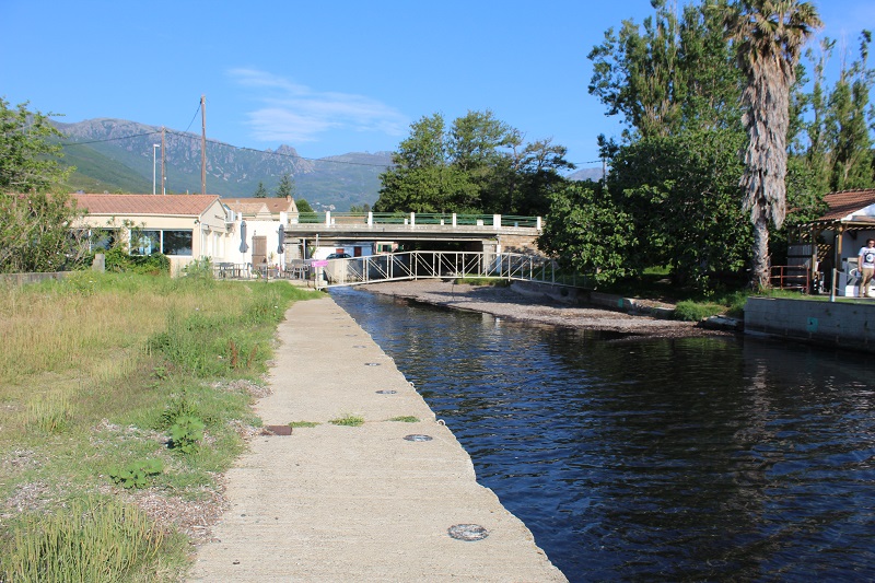
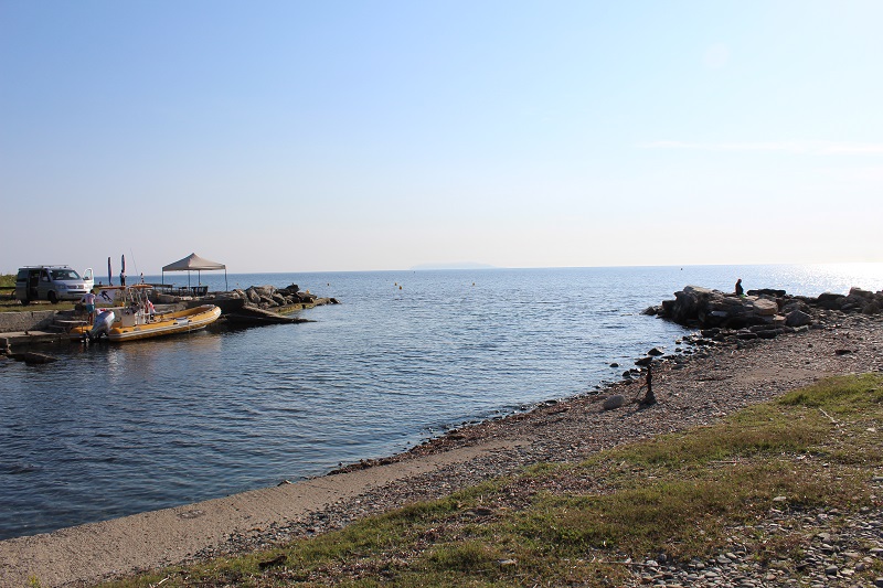
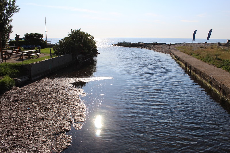
FR833COR020 - Marais de Sisco
Wetland data
Basic information
| Wetland location: |
Marine / Coastal |
| Wetland type: |
Natural |
| Wetland area: |
1.6 Ha |
| Hydrological interaction: |
- |
| Water salinity: |
Brackish (0.5 - 18.0 g/l) |
| Type of fresh water input: |
Torrent / Stream - Unconfined aquifer |
| Surface water runoff |
Outflow from lakeshore or river |
| Open water area (%): |
76 - 95 |
| Hydroperiod: |
Permanent |
Geographic information
| Region: |
Corsica |
| Sub region: |
Bastia |
| Island: |
Corsica |
| Municipality: |
Sisco |
| Longitude: |
9.486858 East |
| Latitude: |
42.810530 North |
Wetland condition
| Wetland status (MEDWET): |
5 - Original habitats / landform totally changed |
Ramsar wetland type
| Type |
Coverage (%) |
| F -- Estuarine waters; permanent water of estuaries and estuarine systems of deltas |
> 95 |
Property status
Protection statuses
| Protection status category |
Protection status subcategory |
Area's name |
Code |
Coverage area (%) |
Legislation |
| National/Regional Protection |
Marine natural Park |
Cap Corse et Agriate |
|
12 |
L.334-3 à L.334-8 Code Env. |
| International Protection |
Special Protection Area (SPA) |
Cap Corse plateau |
FR9412009 |
10 |
D 95-631/05.05.95 |
| International Protection |
Special Area of Conservation (SAC) |
Cap Corse plateau |
FR9402013 |
10 |
D 95-631/05.05.95 |
IUCN protection status
| IUCN code |
IUCN Category |
| IV |
Aire de gestion des habitats ou espèces |
| V |
Paysage terrestre ou marin protégé |
| VI |
Aire protégée avec utilisation durable des ressources naturelles |
Ecosystem services
| Type of ecosystem service |
Ecosystem service |
Scale of Βenefit (%) |
Importance |
| Regulatory services |
Local climate regulation |
Local (<2km) |
1 - 1000 people benefitting |
| Regulatory services |
Flood hazard regulation |
Local (<2km) |
1 - 1000 people benefitting |
| Regulatory services |
Visual buffering |
Local (<2km) |
1 - 1000 people benefitting |
| Regulatory services |
Noise buffering |
Local (<2km) |
1 - 1000 people benefitting |
| Cultural services |
Recreation and tourism |
Local (<2km) |
Significant and/or >1000 people benefitting |
| Cultural services |
Social relations |
Local (<2km) |
Significant and/or >1000 people benefitting |
Activities on wetland
| Activity |
Intensity |
| 403 = dispersed habitation |
Medium |
| 501 = paths tracks cycling tracks |
Low |
| 502 = roads motorways |
Low |
| 504 = port areas |
Low |
| 507 = bridge viaduct |
Medium |
| 530 = Improved access to site |
High |
| 621 = nautical sports |
Low |
| 870 = Dykes embankments artificial beaches general |
High |
Activities on catchment area
| Activity |
Intensity |
| 210 = Professional fishing |
Low |
| 220 = Leisure fishing |
Low |
| 402 = discontinuous urbanisation |
High |
| 501 = paths tracks cycling tracks |
Low |
| 502 = roads motorways |
Low |
| 530 = Improved access to site |
High |
| 608 = camping and caravans |
Medium |
| 621 = nautical sports |
High |
| 870 = Dykes embankments artificial beaches general |
High |
| 954 = invasion by a species |
Low |
Impacts
| Impact |
Intensity |
| ER- = Increase in flow regulation |
Medium |
| HF- = Habitat fragmentation |
Low |
| HL- = Habitat loss |
Low |
| VCX = Introduction of exotic floral species |
Low |
Vegetation types
| Type |
Coverage (%) |
| Shrubby / Arborescent |
5 - 25 |
| Other |
5 - 25 |
| Emergent |
26 - 50 |
Flora
| Species |
Presence status |
References |
| Alnus cordata (Loisel.) Duby, 1828 |
Present |
|
| Arundo donax L., 1753 |
Present |
|
| Ficus carica L., 1753 |
Present |
|
| Hyoseris radiata L., 1753 |
Present |
|
| Nerium oleander L., 1753 |
Present |
|
| Opuntia ficus-indica (L.) Mill., 1768 |
Present |
|
| Plantago coronopus L., 1753 |
Present |
|
| Vitex agnus-castus L., 1753 |
Present |
DREAL Corse (OGREVA) |
Fauna
Birds |
Number of individuals |
Nesting |
References |
| Delichon urbicum (Linnaeus, 1758) |
|
|
|