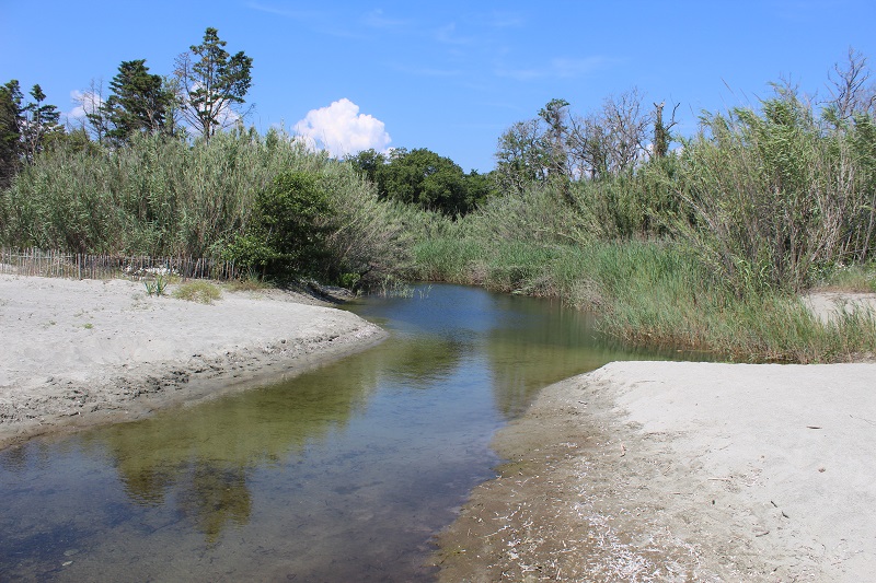
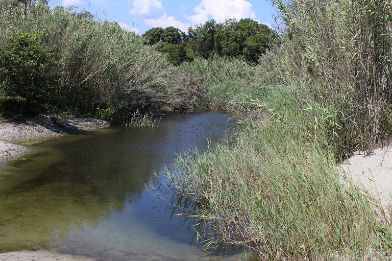
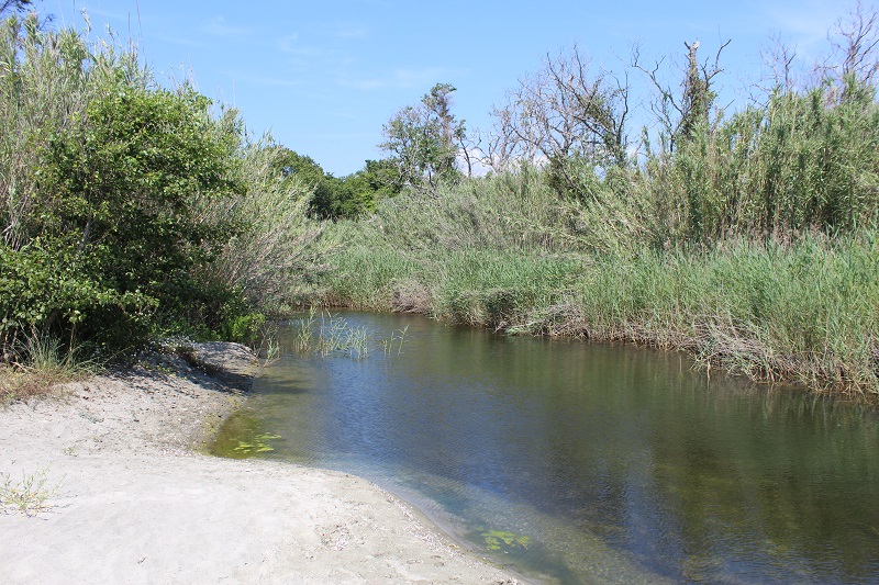
FR835COR048 - Estuaire du Figareto
Wetland data
Basic information
| Wetland location: |
Marine / Coastal |
| Wetland type: |
Natural |
| Wetland area: |
3.5 Ha |
| Hydrological interaction: |
- |
| Water salinity: |
Brackish (0.5 - 18.0 g/l) |
| Type of fresh water input: |
Torrent / Stream - Unconfined aquifer |
| Surface water runoff |
Outflow from lakeshore or river |
| Open water area (%): |
51 - 75 |
| Hydroperiod: |
Permanent |
Geographic information
| Region: |
Corsica |
| Sub region: |
Corte |
| Island: |
Corsica |
| Municipality: |
Talasani |
| Longitude: |
9.534452 East |
| Latitude: |
42.412353 North |
Wetland condition
| Wetland status (MEDWET): |
2 - Original habitats / landform still predominant (>50%) |
Ramsar wetland type
| Type |
Coverage (%) |
| F -- Estuarine waters; permanent water of estuaries and estuarine systems of deltas |
> 95 |
Property status
Protection statuses
| Protection status category |
Protection status subcategory |
Area's name |
Code |
Coverage area (%) |
Legislation |
| International Protection |
Special Area of Conservation (SAC) |
Large herbarium of the eastern coast |
FR9402014 |
2 |
D 95-631/05.05.95 |
IUCN protection status
| IUCN code |
IUCN Category |
| IV |
Aire de gestion des habitats ou espèces |
| V |
Paysage terrestre ou marin protégé |
Ecosystem services
| Type of ecosystem service |
Ecosystem service |
Scale of Βenefit (%) |
Importance |
| Provisioning services |
Fresh water |
Local (<2km) |
Significant and/or >1000 people benefitting |
| Provisioning services |
Food |
Local (<2km) |
Significant and/or >1000 people benefitting |
| Provisioning services |
Fresh water |
Island |
Significant and/or >1000 people benefitting |
| Provisioning services |
Food |
Island |
Significant and/or >1000 people benefitting |
| Regulatory services |
Air quality regulation |
Local (<2km) |
1 - 1000 people benefitting |
| Regulatory services |
Local climate regulation |
Local (<2km) |
1 - 1000 people benefitting |
| Regulatory services |
Disease regulation - livestock |
Local (<2km) |
1 - 1000 people benefitting |
| Regulatory services |
Salinity regulation |
Local (<2km) |
1 - 1000 people benefitting |
| Cultural services |
Social relations |
Local (<2km) |
1 - 1000 people benefitting |
| Supporting services |
Primary production |
Local (<2km) |
1 - 1000 people benefitting |
| Supporting services |
Nutrient cycling |
Local (<2km) |
1 - 1000 people benefitting |
| Supporting services |
Provision of habitat |
Local (<2km) |
1 - 1000 people benefitting |
Activities on wetland
| Activity |
Intensity |
| 220 = Leisure fishing |
Unknown |
| 230 = Hunting |
Unknown |
| 954 = invasion by a species |
Medium |
Activities on catchment area
| Activity |
Intensity |
| 220 = Leisure fishing |
Unknown |
| 230 = Hunting |
Unknown |
| 954 = invasion by a species |
Medium |
Impacts
| Impact |
Intensity |
| ES- = Increase in water supply |
Unknown |
| VCX = Introduction of exotic floral species |
Unknown |
Vegetation types
| Type |
Coverage (%) |
| Shrubby / Arborescent |
26 - 50 |
| Emergent |
26 - 50 |
Flora
| Species |
Presence status |
References |
| Arundo donax L., 1753 |
Present |
|
| Arundo donax L., 1753 |
Present |
|
| Euphorbia peplis L., 1753 |
Present |
DREAL Corse (OGREVA) |
| Phragmites australis (Cav.) Trin. ex Steud., 1840 |
Present |
|
| Rubus sp. L., 1753 |
Present |
|
| Tamarix africana Poir., 1789 |
Present |
|
Fauna
Birds |
Number of individuals |
Nesting |
References |
| Burhinus oedicnemus (Linnaeus, 1758) |
|
|
DREAL Corse (OGREVA) |