
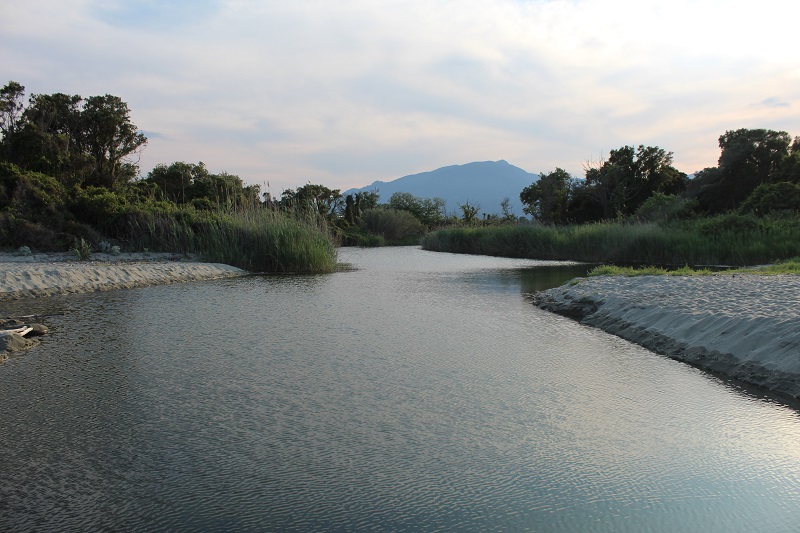
FR835COR058 - Embouchure d'Alesani
Description
Wetland data
Basic information
| Wetland location: | Marine / Coastal |
| Wetland type: | Natural |
| Wetland area: | 5.1 Ha |
| Hydrological interaction: | - |
| Water salinity: | Brackish (0.5 - 18.0 g/l) |
| Type of fresh water input: | Torrent / Stream - Unconfined aquifer |
| Surface water runoff | Outflow from lakeshore or river |
| Open water area (%): | 51 - 75 |
| Hydroperiod: | Permanent |
Geographic information
| Region: | Corsica |
| Sub region: | Corte |
| Island: | Corsica |
| Municipality: | San-Giuliano |
| Longitude: | 9.556549 East |
| Latitude: | 42.287227 North |
Wetland condition
| Wetland status (MEDWET): | 3 - Original habitats / landform partially modified (10-50% untouched) |
Ramsar wetland type
| Type | Coverage (%) |
| F -- Estuarine waters; permanent water of estuaries and estuarine systems of deltas | > 95 |
Property status
| Government - Municipal / Private |
| Protection status category | Protection status subcategory | Area's name | Code | Coverage area (%) | Legislation |
| Other | ZNIEFF type I | Dunes de Prunete et Marais de Canniccia | 94 | ||
| International Protection | Special Area of Conservation (SAC) | Large herbarium of the eastern coast | FR9402014 | 11 | D 95-631/05.05.95 |
IUCN protection status
| IUCN code | IUCN Category |
| IV | Aire de gestion des habitats ou espèces |
| V | Paysage terrestre ou marin protégé |
Ecosystem services
| Type of ecosystem service | Ecosystem service | Scale of Βenefit (%) | Importance |
| Provisioning services | Food | Local (<2km) | Gaps in evidence |
| Regulatory services | Water regulation | Local (<2km) | 1 - 1000 people benefitting |
| Regulatory services | Flood hazard regulation | Local (<2km) | 1 - 1000 people benefitting |
| Regulatory services | Water purification | Local (<2km) | 1 - 1000 people benefitting |
| Regulatory services | Visual buffering | Local (<2km) | 1 - 1000 people benefitting |
| Regulatory services | Noise buffering | Local (<2km) | 1 - 1000 people benefitting |
| Supporting services | Water recycling | Local (<2km) | 1 - 1000 people benefitting |
Activities on wetland
| Activity | Intensity |
| 810 = Drainage | Unknown |
Activities on catchment area
| Activity | Intensity |
| 100 = Cultivation | High |
| 110 = Use of pesticides | Unknown |
| 120 = Fertilisation | Unknown |
| 130 = Irrigation | Unknown |
| 403 = dispersed habitation | Medium |
| 430 = Agricultural structures | Low |
| 501 = paths tracks cycling tracks | Low |
| 502 = roads motorways | High |
| 530 = Improved access to site | Low |
Impacts
| Impact | Intensity |
| ER- = Increase in flow regulation | Unknown |
| HL- = Habitat loss | Medium |
| PF- = Fertilizer/Excess nutrient pollution | Medium |
Flora
| Species | Presence status | References |
| Alnus cordata (Loisel.) Duby, 1828 | Present | |
| Cakile maritima Scop., 1772 | Present | |
| Eryngium maritimum L., 1753 | Present | |
| Phragmites australis (Cav.) Trin. ex Steud., 1840 | Present | |
| Pistacia lentiscus L., 1753 | Present | |
| Rubus sp. L., 1753 | Present | |
| Salsola kali L., 1753 | Present | |
| Schoenoplectus tabernaemontani (C.C.Gmel.) Palla, 1888 | Present | |
| Smilax aspera L., 1753 | Present |
Fauna
Reptiles |
Presence status in wetland |
References |
|
| Emys orbicularis (Linnaeus, 1758) | Present | ZNIEFF - Dunes de Prunete et Marais d... | |
| Hierophis viridiflavus (Lacepède, 1789) | Present | ZNIEFF - Dunes de Prunete et Marais d... | |
| Podarcis tiliguerta (Gmelin, 1789) | Present | ZNIEFF - Dunes de Prunete et Marais d... | |
| Testudo hermanni (Gmelin, 1789) | Present | ZNIEFF - Dunes de Prunete et Marais d... | |
Amphibians |
Presence status in wetland |
References |
|
| Pelophylax lessonae bergeri (Günther in Engelmann, Fritzsche, Günther & Obst, 1986) | Present | ||
Invertebrates |
Presence status in wetland |
References |
|
| Aeshna mixta (Latreille, 1805) | Present | DREAL Corse (OGREVA) | |
| Sympetrum sanguineum (O.F. Müller, 1764) | Present | DREAL Corse (OGREVA) | |
| Sympetrum striolatum (Charpentier, 1840) | Present | DREAL Corse (OGREVA) | |
Birds |
Number of individuals |
Nesting |
References |
| Cettia cetti (Temminck, 1820) |
Images


