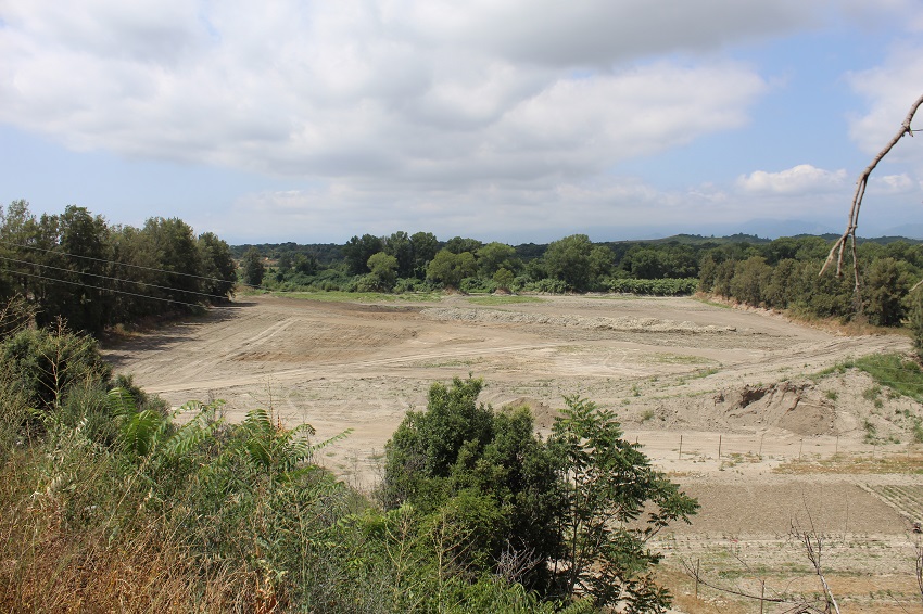
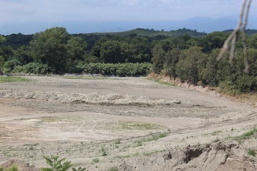
FR835COR074 - Bassin de carrière de Rottani
Wetland data
Basic information
| Wetland location: |
Inland |
| Wetland type: |
Artificial |
| Wetland area: |
4.4 Ha |
| Hydrological interaction: |
- |
| Water salinity: |
Fresh (< 0.5 g/l) |
| Type of fresh water input: |
Catchment area (precipitation) |
| Surface water runoff |
Unknown |
| Open water area (%): |
51 - 75 |
| Hydroperiod: |
Temporary / Intermittent |
Geographic information
| Region: |
Corsica |
| Sub region: |
Corte |
| Island: |
Corsica |
| Municipality: |
Aléria |
| Longitude: |
9.460017 East |
| Latitude: |
42.129601 North |
Biological significance
| Biological significance: |
Negative |
Ramsar wetland type
| Type |
Coverage (%) |
| 7 -- Excavations; gravel/brick/clay pits; borrow pits, mining pools |
> 95 |
Property status
Activities on wetland
| Activity |
Intensity |
| 100 = Cultivation |
High |
| 300 = Sand and gravel extraction |
High |
| 511 = electricity lines |
Low |
| 710 = Noise nuisance |
High |
| 954 = invasion by a species |
High |
Activities on catchment area
| Activity |
Intensity |
| 100 = Cultivation |
Low |
| 140 = Grazing |
Unknown |
| 220 = Leisure fishing |
Low |
| 230 = Hunting |
Unknown |
| 300 = Sand and gravel extraction |
High |
| 401 = continuous urbanisation |
Medium |
| 412 = industrial stockage |
Low |
| 440 = Storage of materials |
Low |
| 501 = paths tracks cycling tracks |
Low |
| 502 = roads motorways |
Low |
| 511 = electricity lines |
Medium |
| 530 = Improved access to site |
Low |
| 701 = water pollution |
Unknown |
| 710 = Noise nuisance |
Medium |
Impacts
| Impact |
Intensity |
| AN- = Increase in noise |
High |
| EE- = Increase of economic potential |
High |
| PO- = Oil pollution |
Low |
| PS- = Sewage pollution |
High |
| SP- = Soil compaction |
High |
| VCX = Introduction of exotic floral species |
High |
Vegetation types
| Type |
Coverage (%) |
| Shrubby / Arborescent |
5 - 25 |
Flora
| Species |
Presence status |
References |
| Ailanthus altissima (Mill.) Swingle, 1916 |
Present |
|
| Arundo donax L., 1753 |
Present |
|
| Foeniculum vulgare Mill., 1768 |
Present |
|
Fauna
Birds |
Number of individuals |
Nesting |
References |
| Milvus milvus (Linnaeus, 1758) |
|
|
|
| Merops apiaster (Linnaeus, 1758) |
|
|
|