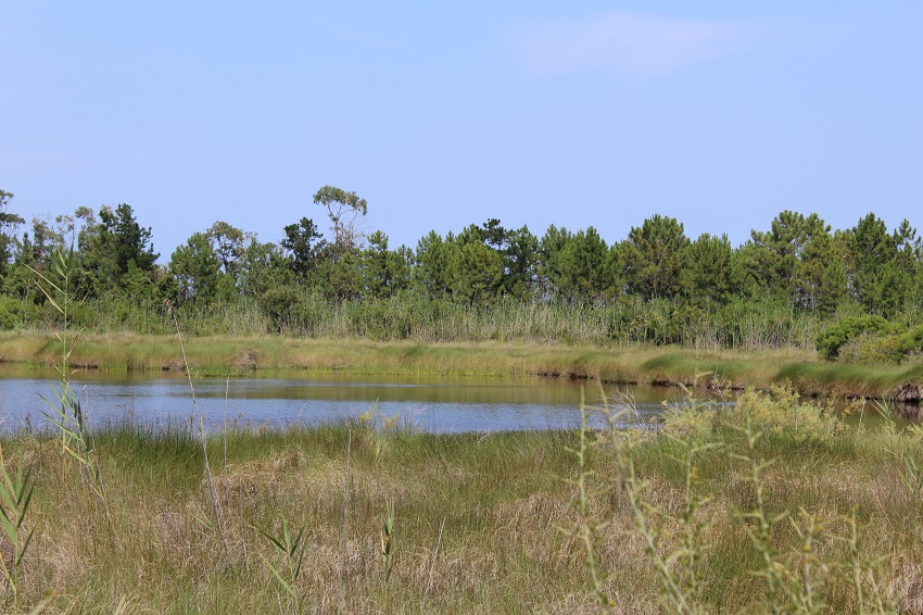
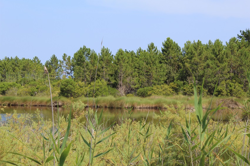
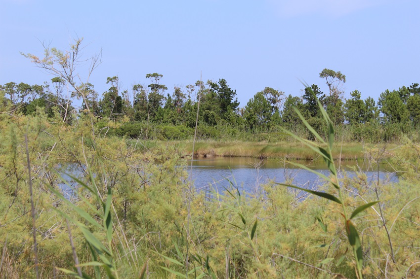
FR835COR083 - Pozzi Piatti
Wetland data
Basic information
| Wetland location: |
Marine / Coastal |
| Wetland type: |
Natural |
| Wetland area: |
5.6 Ha |
| Hydrological interaction: |
- |
| Water salinity: |
Brackish (0.5 - 18.0 g/l) |
| Type of fresh water input: |
Catchment area (precipitation) |
| Surface water runoff |
There is no obvious water outflow |
| Open water area (%): |
51 - 75 |
| Hydroperiod: |
Permanent |
Geographic information
| Region: |
Corsica |
| Sub region: |
Corte |
| Island: |
Corsica |
| Municipality: |
Aléria |
| Longitude: |
9.498113 East |
| Latitude: |
42.052856 North |
Wetland condition
| Wetland status (MEDWET): |
1 - Untouched. No signs of man-made changes |
Ramsar wetland type
| Type |
Coverage (%) |
| H -- Intertidal marshes; includes salt marshes, salt meadows, saltings, raised salt marshes; includes tidal brackish and freshwater marshes |
> 95 |
Property status
Protection statuses
| Protection status category |
Protection status subcategory |
Area's name |
Code |
Coverage area (%) |
Legislation |
| Other |
ZNIEFF type I |
ETANG ET ZONE HUMIDE D'URBINO |
|
94 |
|
| Other |
ZNIEFF type II |
Littoral, boisements et zones humides de Casabianda et Pinia |
|
4 |
|
| International Protection |
Special Protection Area (SPA) |
Urbino |
FR9410098 |
100 |
D 95-631/05.05.95 |
CDDA protection status
| CDDA code |
CDDA category |
| FR20 |
Approved Hunting Reserve |
IUCN protection status
| IUCN code |
IUCN Category |
| IV |
Aire de gestion des habitats ou espèces |
| V |
Paysage terrestre ou marin protégé |
Ecosystem services
| Type of ecosystem service |
Ecosystem service |
Scale of Βenefit (%) |
Importance |
| Supporting services |
Nutrient cycling |
Local (<2km) |
1 - 1000 people benefitting |
| Supporting services |
Water recycling |
Local (<2km) |
1 - 1000 people benefitting |
| Supporting services |
Provision of habitat |
Local (<2km) |
1 - 1000 people benefitting |
Activities on wetland
| Activity |
Intensity |
| 010 = Habitat conservation |
High |
| 030 = Species conservation |
High |
| 140 = Grazing |
Low |
Activities on catchment area
| Activity |
Intensity |
| 010 = Habitat conservation |
High |
| 030 = Species conservation |
High |
| 100 = Cultivation |
Medium |
| 140 = Grazing |
Low |
| 220 = Leisure fishing |
Medium |
| 230 = Hunting |
Low |
| 403 = dispersed habitation |
Low |
| 501 = paths tracks cycling tracks |
Medium |
| 502 = roads motorways |
Low |
| 530 = Improved access to site |
Medium |
| 621 = nautical sports |
Medium |
Impacts
| Impact |
Intensity |
| ES- = Increase in water supply |
High |
| ET- = Increase in toxicant removal/retention |
High |
| EW- = Increase in wilderness/wildlife values |
Low |
Vegetation types
| Type |
Coverage (%) |
| Shrubby / Arborescent |
26 - 50 |
| Emergent |
51 - 75 |
| Floating-leaved |
5 - 25 |
| Halophytic |
51 - 75 |
| Submerged |
5 - 25 |
Flora
| Species |
Presence status |
References |
| Bolboschoenus maritimus (L.) Palla, 1905 |
Present |
|
| Carex extensa Gooden., 1794 |
Present |
|
| Cistus halimifolius L., 1753 |
Present |
|
| Dittrichia viscosa (L.) Greuter, 1973 |
Present |
|
| Juncus effusus L., 1753 |
Present |
|
| Juncus maritimus Lam., 1794 |
Present |
|
| Juncus subulatus Forssk., 1775 |
Present |
|
| Phragmites australis (Cav.) Trin. ex Steud., 1840 |
Present |
|
| Pinus pinaster Aiton, 1789 |
Present |
|
| Pistacia lentiscus L., 1753 |
Present |
|
| Tamarix africana Poir., 1789 |
Present |
|
Fauna
Birds |
Number of individuals |
Nesting |
References |
| Ardea cinerea (Linnaeus, 1758) |
|
|
|