Le barrage d'Alzitone, d'une longueur de 307 mètres et haut de 32.3 mètres, est un barrage hydrolique du Département de la Haute-Corse situé sur le territoire de la commune d'Aghione.
Le barrage d'Alzitone a été construit en 1965 en travers de la rivière Pedocchino retient un volume d'eau de 5 600 milliers de m³ sur une surface de 49 hectares. Le barrage a pour usage principaux : Irrigation,Alimentation en eau et Hydroélectricité. (Inventaire le 28/06/19 par E.Tankovic)
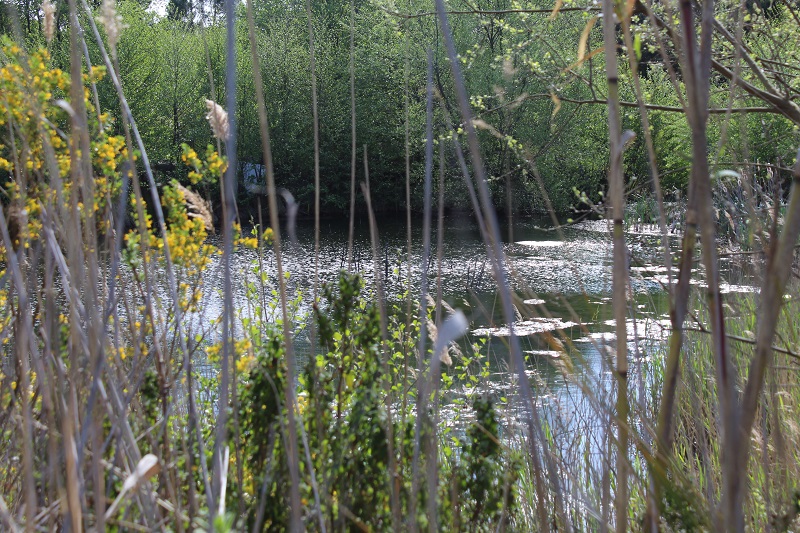
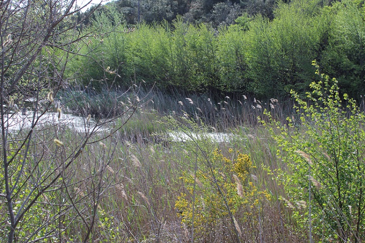
Wetland data
Basic information
Wetland location:
Inland
Wetland type:
Natural
Wetland area:
0.5 Ha
Hydrological interaction:
-
Water salinity:
Fresh (< 0.5 g/l)
Type of fresh water input:
Torrent / Stream - Unconfined aquifer
Surface water runoff
Outflow from lakeshore or river
Open water area (%):
51 - 75
Hydroperiod:
Permanent
Geographic information
Region:
Corsica
Sub region:
Sartène
Island:
Corsica
Municipality:
San-Gavino-di-Carbini
Longitude:
9.269170 East
Latitude:
41.639135 North
Wetland condition
Wetland status (MEDWET):
2 - Original habitats / landform still predominant (>50%)
Ramsar wetland type
Type
Coverage (%)
Tp -- Permanent freshwater marshes/pools; ponds (below 8 ha), marshes and swamps on inorganic soils; with emergent vegetation water-logged for at least most of the growing season
> 95
Property status
Private
Protection statuses
Protection status category
Protection status subcategory
Area's name
Code
Coverage area (%)
Legislation
Other
ZNIEFF type II
SUBERAIE DE PORTO VECCHIO
100
Ecosystem services
Type of ecosystem service
Ecosystem service
Scale of Βenefit (%)
Importance
Provisioning services
Fresh water
Local (<2km)
1 - 1000 people benefitting
Regulatory services
Fire regulation
Local (<2km)
1 - 1000 people benefitting
Activities on wetland
Activity
Intensity
100 = Cultivation
Low
230 = Hunting
Medium
810 = Drainage
Unknown
Activities on catchment area
Activity
Intensity
130 = Irrigation
Low
140 = Grazing
Low
230 = Hunting
Medium
402 = discontinuous urbanisation
Medium
409 = other patterns of habitation
Low
421 = disposal of household waste
Medium
422 = disposal of industrial waste
Medium
423 = disposal of inert materials
Medium
501 = paths tracks cycling tracks
Low
502 = roads motorways
Low
511 = electricity lines
Medium
530 = Improved access to site
Low
Impacts
Impact
Intensity
ES- = Increase in water supply
Low
WG- = Drainage/Reduction of water level
Medium
Vegetation types
Type
Coverage (%)
Shrubby / Arborescent
26 - 50
Emergent
5 - 25
Floating-leaved
5 - 25
Flora
Species
Presence status
References
Alnus glutinosa (L.) Gaertn., 1790
Present
Arundo donax L., 1753
Present
Phragmites australis (Cav.) Trin. ex Steud., 1840
Present
Rubus sp. L., 1753
Present
Typha latifolia L., 1753
Present
Images
PIM Initiative, Corsican Environment Office (OEC). (2019). FrIsWet – Database of the French island wetlands. Updated: 05.2024