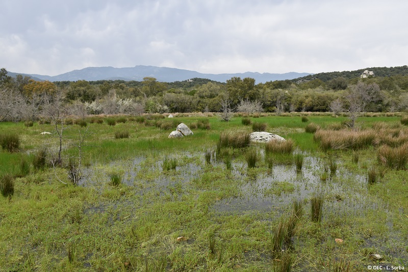
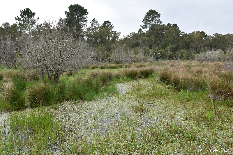
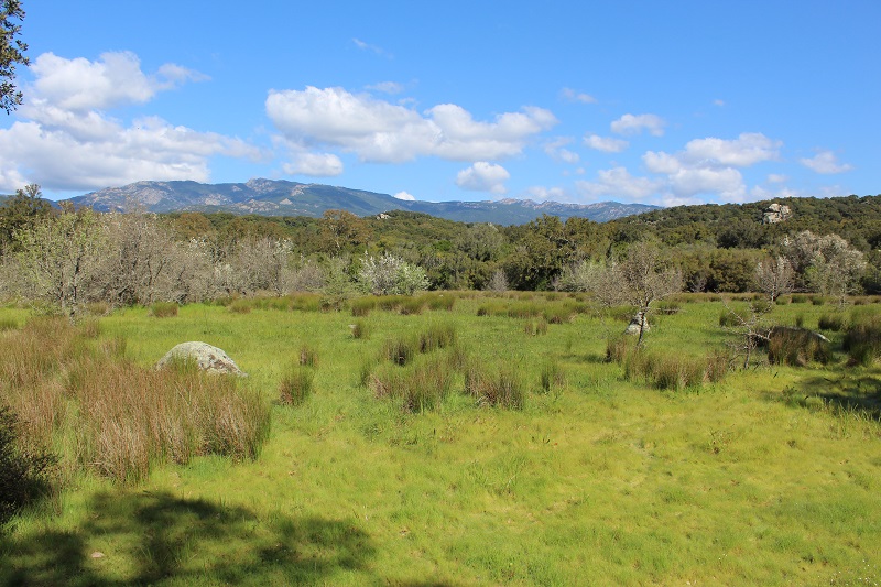
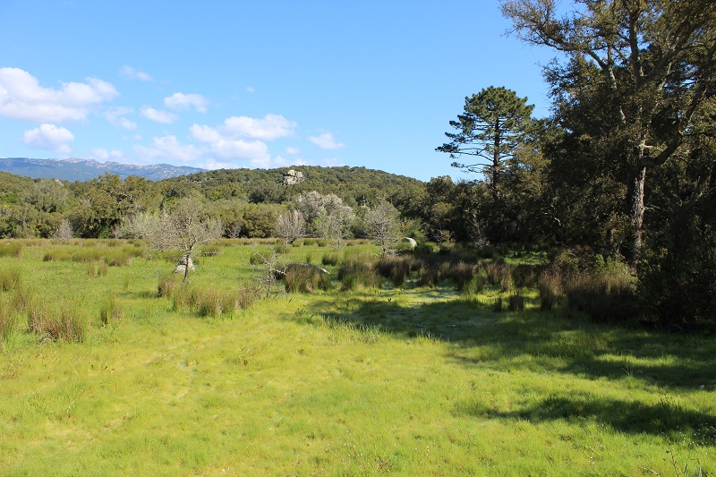
FR831COR145 - Mare de Balési
Wetland data
Basic information
| Wetland location: |
Inland |
| Wetland type: |
Natural |
| Wetland area: |
0.9 Ha |
| Hydrological interaction: |
- |
| Water salinity: |
Fresh (< 0.5 g/l) |
| Type of fresh water input: |
Torrent / Stream - Unconfined aquifer |
| Surface water runoff |
There is no obvious water outflow |
| Open water area (%): |
5 - 25 |
| Hydroperiod: |
Temporary / Intermittent |
Geographic information
| Region: |
Corsica |
| Sub region: |
Sartène |
| Island: |
Corsica |
| Municipality: |
Porto-Vecchio |
| Longitude: |
9.221041 East |
| Latitude: |
41.580518 North |
Wetland condition
| Wetland status (MEDWET): |
2 - Original habitats / landform still predominant (>50%) |
Ramsar wetland type
| Type |
Coverage (%) |
| Ts -- Seasonal/intermittent freshwater marshes/pools on inorganic soils; includes sloughs, potholes, seasonally flooded meadows, sedge marshes |
> 95 |
Property status
Protection statuses
| Protection status category |
Protection status subcategory |
Area's name |
Code |
Coverage area (%) |
Legislation |
| Other |
ZNIEFF type I |
MARE TEMPORAIRE et SUBERAIES DE MURATELLU |
|
100 |
|
| Other |
ZNIEFF type II |
SUBERAIE DE PORTO VECCHIO |
|
30 |
|
| International Protection |
Special Area of Conservation (SAC) |
Ceccia/Porto-Vecchio Suberaie |
FR9400588 |
100 |
D 95-631/05.05.95 |
IUCN protection status
| IUCN code |
IUCN Category |
| IV |
Aire de gestion des habitats ou espèces |
| V |
Paysage terrestre ou marin protégé |
Ecosystem services
| Type of ecosystem service |
Ecosystem service |
Scale of Βenefit (%) |
Importance |
| Provisioning services |
Food |
Local (<2km) |
1 - 1000 people benefitting |
| Supporting services |
Provision of habitat |
Local (<2km) |
1 - 1000 people benefitting |
Activities on wetland
| Activity |
Intensity |
| 140 = Grazing |
Low |
| 230 = Hunting |
High |
| 243 = trapping poisoning poaching |
Unknown |
| 530 = Improved access to site |
Low |
Activities on catchment area
| Activity |
Intensity |
| 100 = Cultivation |
Low |
| 120 = Fertilisation |
Medium |
| 140 = Grazing |
Medium |
| 230 = Hunting |
High |
| 243 = trapping poisoning poaching |
Unknown |
| 403 = dispersed habitation |
Low |
| 422 = disposal of industrial waste |
Low |
| 423 = disposal of inert materials |
Low |
| 501 = paths tracks cycling tracks |
Low |
| 530 = Improved access to site |
Low |
Impacts
| Impact |
Intensity |
| ES- = Increase in water supply |
Low |
Habitat types
| Type |
Coverage (%) |
| 3170 * Mediterranean temporary ponds |
> 95 |
Vegetation types
| Type |
Coverage (%) |
| Shrubby / Arborescent |
26 - 50 |
| Emergent |
51 - 75 |
| Wet meadow |
51 - 75 |
| Submerged |
< 5 |
Flora
| Species |
Presence status |
References |
| Arbutus unedo L., 1753 |
Present |
|
| Bellis annua L., 1753 |
Present |
|
| Cistus monspeliensis L., 1753 |
Present |
|
| Erica arborea L., 1753 |
Present |
|
| Geranium dissectum L., 1755 |
Present |
|
| Iris pseudacorus L., 1753 |
Present |
|
| Juncus acutus L., 1753 |
Present |
|
| Phillyrea angustifolia L., 1753 |
Present |
|
| Pinus pinea L., 1753 |
Present |
|
| Pistacia lentiscus L., 1753 |
Present |
|
| Prunus spinosa L., 1753 |
Present |
|
| Quercus suber L., 1753 |
Present |
|
| Ruscus aculeatus L., 1753 |
Present |
|
Fauna
Birds |
Number of individuals |
Nesting |
References |
| Milvus milvus (Linnaeus, 1758) |
|
|
|
| Corvus corax (Linnaeus, 1758) |
|
|
|
| Corvus corone cornix (Linnaeus, 1758) |
|
|
|
| Garrulus glandarius (Linnaeus, 1758) |
|
|
|
| Turdus merula (Linnaeus, 1758) |
|
|
|
| Ardea cinerea (Linnaeus, 1758) |
|
|
|