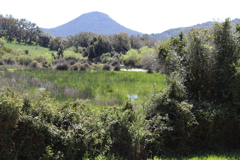
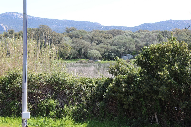
FR831COR148 - Marais de Biaggiola
Wetland data
Basic information
| Wetland location: |
Inland |
| Wetland type: |
Artificial |
| Wetland area: |
2.7 Ha |
| Hydrological interaction: |
- |
| Water salinity: |
Fresh (< 0.5 g/l) |
| Type of fresh water input: |
Catchment area (precipitation) |
| Surface water runoff |
There is no obvious water outflow |
| Open water area (%): |
5 - 25 |
| Hydroperiod: |
Permanent |
Geographic information
| Region: |
Corsica |
| Sub region: |
Sartène |
| Island: |
Corsica |
| Municipality: |
Porto-Vecchio |
| Longitude: |
9.266916 East |
| Latitude: |
41.575251 North |
Biological significance
| Biological significance: |
Medium |
Ramsar wetland type
| Type |
Coverage (%) |
| 2 -- Ponds; includes farm ponds, stock ponds, small tanks; (generally below 8 ha) |
> 95 |
Property status
Protection statuses
| Protection status category |
Protection status subcategory |
Area's name |
Code |
Coverage area (%) |
Legislation |
| Other |
ZNIEFF type II |
SUBERAIE DE PORTO VECCHIO |
|
100 |
|
| International Protection |
Special Area of Conservation (SAC) |
Ceccia/Porto-Vecchio Suberaie |
FR9400588 |
100 |
D 95-631/05.05.95 |
IUCN protection status
| IUCN code |
IUCN Category |
| IV |
Aire de gestion des habitats ou espèces |
| V |
Paysage terrestre ou marin protégé |
Ecosystem services
| Type of ecosystem service |
Ecosystem service |
Scale of Βenefit (%) |
Importance |
| Provisioning services |
Fresh water |
Local (<2km) |
1 - 1000 people benefitting |
| Provisioning services |
Food |
Local (<2km) |
1 - 1000 people benefitting |
| Regulatory services |
Air quality regulation |
Local (<2km) |
1 - 1000 people benefitting |
| Regulatory services |
Local climate regulation |
Local (<2km) |
1 - 1000 people benefitting |
| Regulatory services |
Visual buffering |
Local (<2km) |
1 - 1000 people benefitting |
Activities on wetland
| Activity |
Intensity |
| 100 = Cultivation |
Low |
| 140 = Grazing |
Unknown |
| 421 = disposal of household waste |
Low |
| 511 = electricity lines |
Medium |
| 710 = Noise nuisance |
High |
| 954 = invasion by a species |
Low |
Activities on catchment area
| Activity |
Intensity |
| 100 = Cultivation |
Medium |
| 110 = Use of pesticides |
Unknown |
| 120 = Fertilisation |
Unknown |
| 130 = Irrigation |
Unknown |
| 140 = Grazing |
Unknown |
| 230 = Hunting |
Low |
| 401 = continuous urbanisation |
Medium |
| 410 = Industrial or commercial areas |
Low |
| 421 = disposal of household waste |
Low |
| 501 = paths tracks cycling tracks |
Low |
| 502 = roads motorways |
High |
| 511 = electricity lines |
Low |
| 530 = Improved access to site |
Medium |
| 606 = attraction park |
Medium |
| 623 = motorised vehicles |
High |
| 710 = Noise nuisance |
High |
Impacts
| Impact |
Intensity |
| EE- = Increase of economic potential |
Low |
| ES- = Increase in water supply |
Unknown |
| HF- = Habitat fragmentation |
Low |
| PF- = Fertilizer/Excess nutrient pollution |
Medium |
| VCX = Introduction of exotic floral species |
High |
Habitat types
| Type |
Coverage (%) |
| 92A0 Salix alba and Populus alba galleries |
< 5 |
| 2210 Crucianellion maritimae fixed beach dunes |
< 5 |
| 3110 Oligotrophic waters containing very few minerals of sandy plains (Littorelletalia uniflorae) |
< 5 |
| 92D0 Southern riparian galleries and thickets (Nerio-Tamaricetea and Securinegion tinctoriae) |
< 5 |
| 9340 Quercus ilex and Quercus rotundifolia forests |
< 5 |
Vegetation types
| Type |
Coverage (%) |
| Shrubby / Arborescent |
26 - 50 |
| Emergent |
76 - 95 |
| Floating-leaved |
5 - 25 |
| Wet meadow |
5 - 25 |
| Submerged |
5 - 25 |
Flora
| Species |
Presence status |
References |
| Alnus glutinosa (L.) Gaertn., 1790 |
Present |
|
| Asphodelus ramosus L., 1753 |
Present |
|
| Juncus sp. L., 1753 |
Present |
|
| Olea europaea L., 1753 |
Present |
|
| Pinus pinea L., 1753 |
Present |
|
| Pistacia lentiscus L., 1753 |
Present |
|
| Quercus suber L., 1753 |
Present |
|
| Rubus sp. L., 1753 |
Present |
|
| Smilax aspera L., 1753 |
Present |
|
Fauna
Reptiles |
Presence status in wetland |
|
References |
| Emys orbicularis (Linnaeus, 1758) |
Present |
|
Fleuriau & Bosc (2013) - Etude de la ... |
Amphibians |
Presence status in wetland |
|
References |
| Pelophylax lessonae bergeri (Günther in Engelmann, Fritzsche, Günther & Obst, 1986) |
Present |
|
|
Birds |
Number of individuals |
Nesting |
References |
| Corvus corone cornix (Linnaeus, 1758) |
|
|
|
| Sylvia melanocephala (Gmelin, 1789) |
|
|
|
| Turdus merula (Linnaeus, 1758) |
|
|
|
| Ardea cinerea (Linnaeus, 1758) |
|
|
|