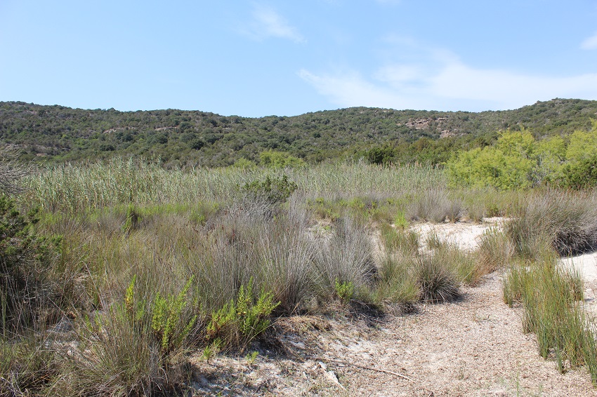
FR831COR158 - Etang de Carataggio
Wetland data
Basic information
| Wetland location: |
Marine / Coastal |
| Wetland type: |
Natural |
| Wetland area: |
1.4 Ha |
| Hydrological interaction: |
- |
| Water salinity: |
Brackish (0.5 - 18.0 g/l) |
| Type of fresh water input: |
Torrent / Stream - Unconfined aquifer |
| Surface water runoff |
Outflow from lakeshore or river |
| Open water area (%): |
26 - 50 |
| Hydroperiod: |
Permanent |
Geographic information
| Region: |
Corsica |
| Sub region: |
Sartène |
| Island: |
Corsica |
| Municipality: |
Porto-Vecchio |
| Longitude: |
9.346086 East |
| Latitude: |
41.575042 North |
Wetland condition
| Wetland status (MEDWET): |
2 - Original habitats / landform still predominant (>50%) |
Ramsar wetland type
| Type |
Coverage (%) |
| F -- Estuarine waters; permanent water of estuaries and estuarine systems of deltas |
5 - 25 |
| H -- Intertidal marshes; includes salt marshes, salt meadows, saltings, raised salt marshes; includes tidal brackish and freshwater marshes |
51 - 75 |
Property status
Protection statuses
| Protection status category |
Protection status subcategory |
Area's name |
Code |
Coverage area (%) |
Legislation |
| Other |
ZNIEFF type I |
COTE ET ILOT DE FARINA |
|
77 |
|
| International Protection |
Special Area of Conservation (SAC) |
Cerbicale Islands and coastal fringe |
FR9400587 |
100 |
D 95-631/05.05.95 |
CDDA protection status
| CDDA code |
CDDA category |
| FR12 |
Site/Monument Registered |
IUCN protection status
| IUCN code |
IUCN Category |
| III |
Monument ou élément naturel |
| IV |
Aire de gestion des habitats ou espèces |
| V |
Paysage terrestre ou marin protégé |
Ecosystem services
| Type of ecosystem service |
Ecosystem service |
Scale of Βenefit (%) |
Importance |
| Provisioning services |
Food |
Local (<2km) |
1 - 1000 people benefitting |
| Regulatory services |
Air quality regulation |
Local (<2km) |
1 - 1000 people benefitting |
| Regulatory services |
Local climate regulation |
Local (<2km) |
1 - 1000 people benefitting |
| Supporting services |
Provision of habitat |
Local (<2km) |
1 - 1000 people benefitting |
Activities on wetland
| Activity |
Intensity |
| 140 = Grazing |
Medium |
| 421 = disposal of household waste |
Low |
| 954 = invasion by a species |
Medium |
Activities on catchment area
| Activity |
Intensity |
| 140 = Grazing |
Medium |
| 220 = Leisure fishing |
Medium |
| 230 = Hunting |
Medium |
| 409 = other patterns of habitation |
Low |
| 421 = disposal of household waste |
Low |
| 501 = paths tracks cycling tracks |
Low |
| 502 = roads motorways |
Low |
| 530 = Improved access to site |
Low |
| 621 = nautical sports |
High |
| 954 = invasion by a species |
Medium |
Impacts
| Impact |
Intensity |
| ES- = Increase in water supply |
Medium |
| EW- = Increase in wilderness/wildlife values |
Low |
| HF- = Habitat fragmentation |
Medium |
| VCX = Introduction of exotic floral species |
Medium |
Vegetation types
| Type |
Coverage (%) |
| Shrubby / Arborescent |
51 - 75 |
| Emergent |
51 - 75 |
| Floating-leaved |
< 5 |
| Halophytic |
< 5 |
| Submerged |
26 - 50 |
Flora
| Species |
Presence status |
References |
| Dittrichia viscosa (L.) Greuter, 1973 |
Present |
|
| Elytrigia juncea (L.) Nevski, 1936 |
Present |
|
| Juncus acutus L., 1753 |
Present |
|
| Juncus maritimus Lam., 1794 |
Present |
|
| Pancratium maritimum L., 1753 |
Present |
|
| Phragmites australis (Cav.) Trin. ex Steud., 1840 |
Present |
|
| Pistacia lentiscus L., 1753 |
Present |
|
| Rubus sp. L., 1753 |
Present |
|
| Rumex sp. L., 1753 |
Present |
|
| Schoenoplectus lacustris (L.) Palla, 1888 |
Present |
|
| Scolymus hispanicus L., 1753 |
Present |
|
| Smilax aspera L., 1753 |
Present |
|
| Tamarix africana Poir., 1789 |
Present |
|
| Typha latifolia L., 1753 |
Present |
|
Fauna
Reptiles |
Presence status in wetland |
|
References |
| Emys orbicularis (Linnaeus, 1758) |
Present |
|
Fleuriau & Bosc (2013) - Etude de la ... |
Birds |
Number of individuals |
Nesting |
References |
| Fulica atra (Linnaeus, 1758) |
|
|
|