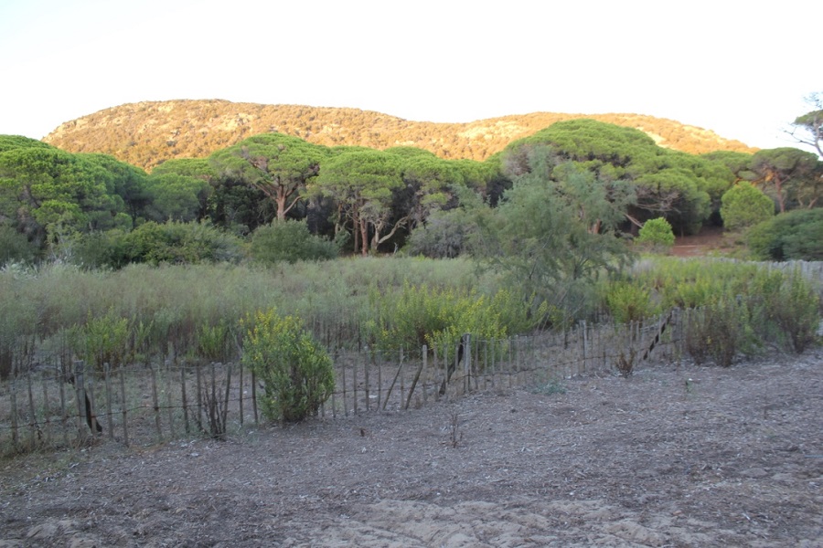
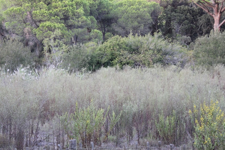
FR831COR159 - Mare de Palombaggia 2
Wetland data
Basic information
| Wetland location: |
Marine / Coastal |
| Wetland type: |
Natural |
| Wetland area: |
0.2 Ha |
| Hydrological interaction: |
- |
| Water salinity: |
Brackish (0.5 - 18.0 g/l) |
| Type of fresh water input: |
Catchment area (precipitation) |
| Surface water runoff |
There is no obvious water outflow |
| Open water area (%): |
< 5 |
| Hydroperiod: |
Temporary / Intermittent |
Geographic information
| Region: |
Corsica |
| Sub region: |
Sartène |
| Island: |
Corsica |
| Municipality: |
Porto-Vecchio |
| Longitude: |
9.336223 East |
| Latitude: |
41.560328 North |
Wetland condition
| Wetland status (MEDWET): |
3 - Original habitats / landform partially modified (10-50% untouched) |
Ramsar wetland type
| Type |
Coverage (%) |
| Ss -- Seasonal/intermittent saline/brackish/alkaline marshes/pools |
> 95 |
Property status
| Conservatoire du littoral |
Protection statuses
| Protection status category |
Protection status subcategory |
Area's name |
Code |
Coverage area (%) |
Legislation |
| National/Regional Protection |
Land acquired by the Conservatoire du littoral |
PALUMBAGGIA |
|
100 |
L.322-1 Code Env. |
| Other |
ZNIEFF type I |
ETANGS ET PINEDE DE PALOMBAGGIA, CAPU D’ACCIAJU, POINTE DE LA FOLACA |
|
100 |
|
| International Protection |
Special Area of Conservation (SAC) |
Cerbicale Islands and coastal fringe |
FR9400587 |
100 |
D 95-631/05.05.95 |
CDDA protection status
| CDDA code |
CDDA category |
| FR12 |
Site/Monument Registered |
| FR14 |
Site acquired by the Conservatoire du littoral |
IUCN protection status
| IUCN code |
IUCN Category |
| III |
Monument ou élément naturel |
| IV |
Aire de gestion des habitats ou espèces |
| V |
Paysage terrestre ou marin protégé |
Activities on wetland
| Activity |
Intensity |
| 040 = Land restoration |
High |
| 230 = Hunting |
Medium |
| 871 = sea defense or coast protection works |
Medium |
Activities on catchment area
| Activity |
Intensity |
| 040 = Land restoration |
High |
| 210 = Professional fishing |
Unknown |
| 220 = Leisure fishing |
Unknown |
| 230 = Hunting |
Medium |
| 403 = dispersed habitation |
Medium |
| 501 = paths tracks cycling tracks |
Medium |
| 502 = roads motorways |
Medium |
| 504 = port areas |
Medium |
| 608 = camping and caravans |
High |
| 621 = nautical sports |
High |
| 871 = sea defense or coast protection works |
Medium |
| 954 = invasion by a species |
Medium |
Habitat types
| Type |
Coverage (%) |
| 3170 * Mediterranean temporary ponds |
76 - 95 |
Vegetation types
| Type |
Coverage (%) |
| Shrubby / Arborescent |
5 - 25 |
| Other |
51 - 75 |
| Emergent |
5 - 25 |
Flora
| Species |
Presence status |
References |
| Dittrichia viscosa (L.) Greuter, 1973 |
Present |
|
| Pinus pinea L., 1753 |
Present |
|
| Quercus suber L., 1753 |
Present |
|
| Rubus sp. L., 1753 |
Present |
|
| Smilax aspera L., 1753 |
Present |
|