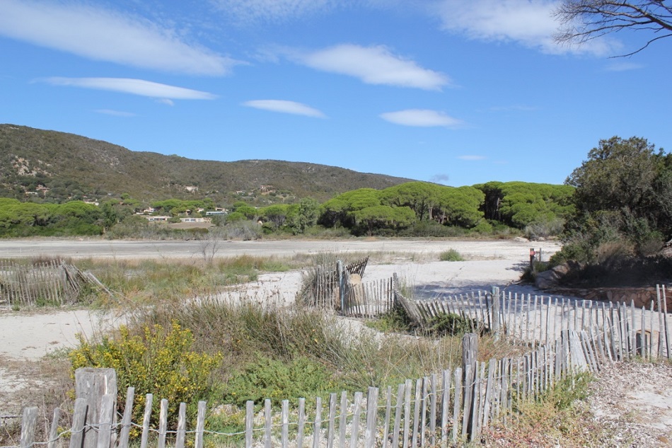
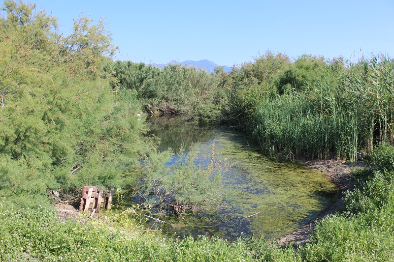
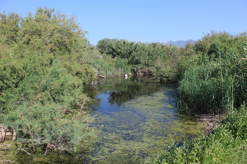
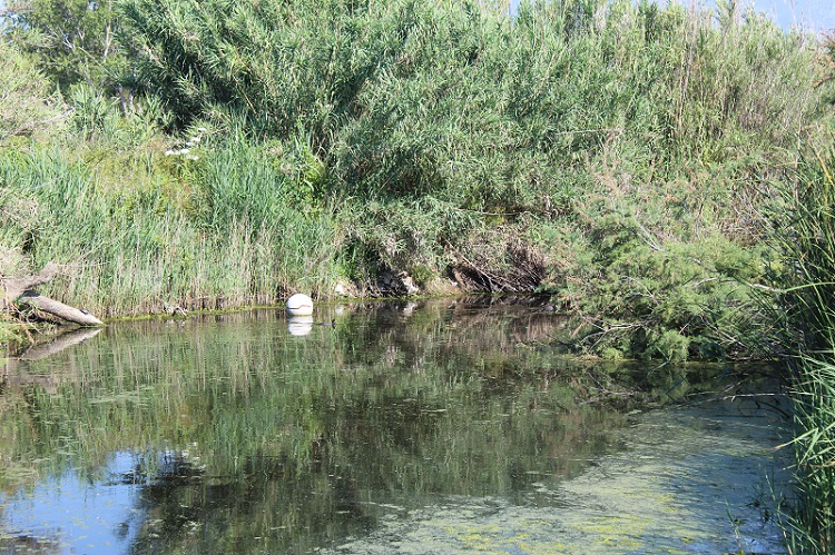
FR831COR161 - Etang de Palombaggia
Wetland data
Basic information
| Wetland location: |
Marine / Coastal |
| Wetland type: |
Natural |
| Wetland area: |
4.2 Ha |
| Hydrological interaction: |
- |
| Water salinity: |
Brackish (0.5 - 18.0 g/l) |
| Type of fresh water input: |
Catchment area (precipitation) |
| Surface water runoff |
Outflow from lakeshore or river |
| Open water area (%): |
76 - 95 |
| Hydroperiod: |
Seasonal |
Geographic information
| Region: |
Corsica |
| Sub region: |
Sartène |
| Island: |
Corsica |
| Municipality: |
Porto-Vecchio |
| Longitude: |
9.330840 East |
| Latitude: |
41.561240 North |
Wetland condition
| Wetland status (MEDWET): |
3 - Original habitats / landform partially modified (10-50% untouched) |
Ramsar wetland type
| Type |
Coverage (%) |
| F -- Estuarine waters; permanent water of estuaries and estuarine systems of deltas |
5 - 25 |
| J -- Coastal brackish/saline lagoons; brackish to saline lagoons with at least one relatively narrow connection to the sea |
76 - 95 |
Property status
Protection statuses
| Protection status category |
Protection status subcategory |
Area's name |
Code |
Coverage area (%) |
Legislation |
| National/Regional Protection |
Land acquired by the Conservatoire du littoral |
PALUMBAGGIA |
|
1 |
L.322-1 Code Env. |
| Other |
ZNIEFF type I |
ETANGS ET PINEDE DE PALOMBAGGIA, CAPU D’ACCIAJU, POINTE DE LA FOLACA |
|
100 |
|
| International Protection |
Special Area of Conservation (SAC) |
Cerbicale Islands and coastal fringe |
FR9400587 |
100 |
D 95-631/05.05.95 |
CDDA protection status
| CDDA code |
CDDA category |
| FR12 |
Site/Monument Registered |
| FR14 |
Site acquired by the Conservatoire du littoral |
IUCN protection status
| IUCN code |
IUCN Category |
| III |
Monument ou élément naturel |
| IV |
Aire de gestion des habitats ou espèces |
| V |
Paysage terrestre ou marin protégé |
Ecosystem services
| Type of ecosystem service |
Ecosystem service |
Scale of Βenefit (%) |
Importance |
| Regulatory services |
Air quality regulation |
Local (<2km) |
Significant and/or >1000 people benefitting |
| Regulatory services |
Local climate regulation |
Local (<2km) |
Significant and/or >1000 people benefitting |
Activities on wetland
| Activity |
Intensity |
| 040 = Land restoration |
High |
| 501 = paths tracks cycling tracks |
High |
| 871 = sea defense or coast protection works |
Medium |
| 954 = invasion by a species |
Medium |
Activities on catchment area
| Activity |
Intensity |
| 040 = Land restoration |
High |
| 210 = Professional fishing |
Unknown |
| 220 = Leisure fishing |
Unknown |
| 403 = dispersed habitation |
Medium |
| 501 = paths tracks cycling tracks |
Medium |
| 502 = roads motorways |
Medium |
| 504 = port areas |
Medium |
| 608 = camping and caravans |
High |
| 621 = nautical sports |
High |
| 871 = sea defense or coast protection works |
Medium |
| 954 = invasion by a species |
Medium |
Impacts
| Impact |
Intensity |
| EF- = Increase in protection from natural forces |
High |
| EP- = Reduction of salt intrusion potential |
High |
| VCX = Introduction of exotic floral species |
Medium |
Habitat types
| Type |
Coverage (%) |
| 1140 Mudflats and sandflats not covered by seawater at low tide |
|
| 2210 Crucianellion maritimae fixed beach dunes |
|
| 2250 * Coastal dunes with Juniperus spp |
|
| 2270 * Wooded dunes with Pinus pinea and/or Pinus pinaster |
|
Vegetation types
| Type |
Coverage (%) |
| Shrubby / Arborescent |
5 - 25 |
| Emergent |
5 - 25 |
| Halophytic |
51 - 75 |
| Ammophilous |
26 - 50 |
Flora
| Species |
Presence status |
References |
| Carpobrotus sp. N.E.Br., 1925 |
Present |
|
| Juncus acutus L., 1753 |
Present |
|
| Pinus pinaster Aiton, 1789 |
Present |
|
| Pinus pinea L., 1753 |
Present |
|
Fauna
Reptiles |
Presence status in wetland |
|
References |
| Emys orbicularis (Linnaeus, 1758) |
Present |
|
Fleuriau & Bosc (2013) - Etude de la ... |