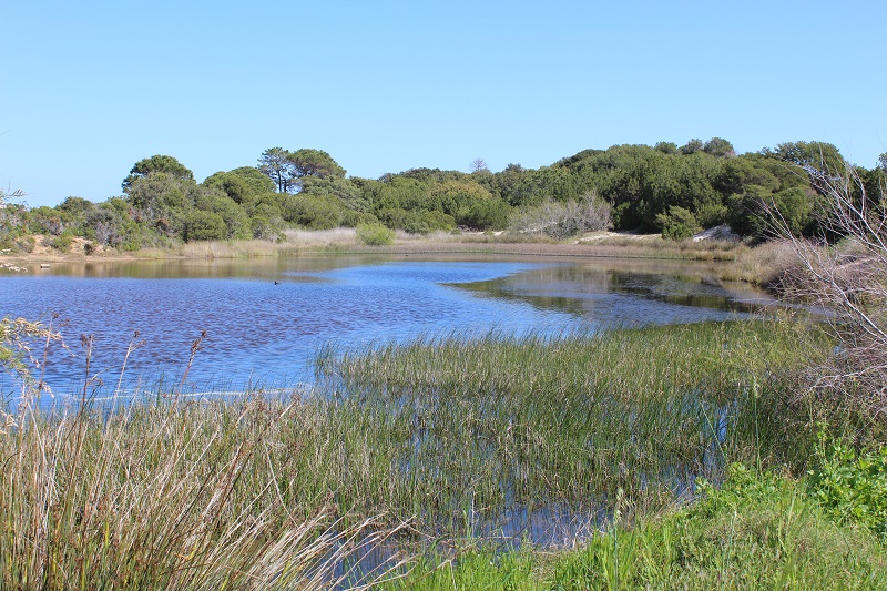
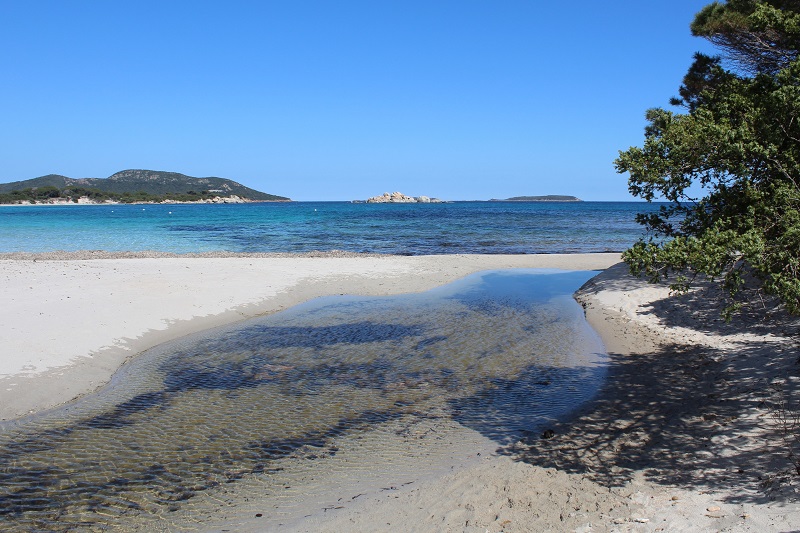
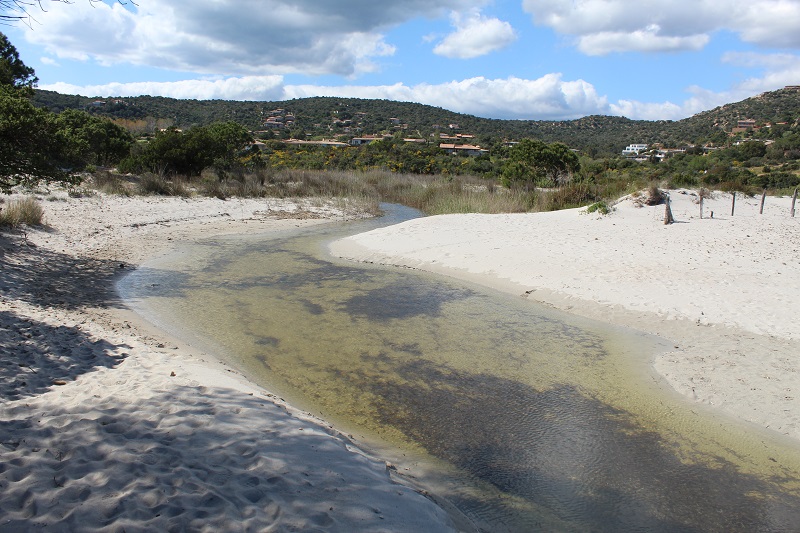
L’étang de Stagnolu est situé au nord de la Bravone à proximité du camping naturiste de Baghera, sur la commune de Linguizetta. La zone humide se présente sous la forme d'un estuaire, commun à plusieurs petits ruisseaux ; la relative étendue du plan d'eau lui confère une allure typique d'étang.
Les alimentations de cet étang sont les eaux de ruissellement canalisées le long des différents talwegs du petit bassin versant. La faiblesse des apports d'eau, rend cet étang estuarien un peu saumâtre à certaines périodes de l'année. L'ouverture du grau est temporaire. Une épaisse roselière bordée d'un boisement de tamaris, ceinture l'étang. A l'ouest les deux alimentations d'eau douce se perdent dans une aulnaie dense. Sur le lido et au sud de la zone, se développe un maquis à lentisques pistachiers et chênes verts. Au niveau de l'arrière-dune, un gazon maritime et une lande à asphodèles recouvrent le sable. L'ensemble de la masse d'eau, assez profonde (environ 1,5 m), est occupé par un herbier à Potamot. Cet étang est très intéressant pour les oiseaux d'eau puisque 5 couples de Nettes rousse y nichent ainsi que le Grèbe huppé et le Blongios nain. (Inventaire le 04/04/2019 par T. Giannakakis et E.Tankovic).
Wetland data
Basic information
Wetland location:
Marine / Coastal
Wetland type:
Natural
Wetland area:
2.7 Ha
Hydrological interaction:
-
Water salinity:
Brackish (0.5 - 18.0 g/l)
Type of fresh water input:
Torrent / Stream - Unconfined aquifer
Surface water runoff
Outflow from lakeshore or river
Open water area (%):
51 - 75
Hydroperiod:
Permanent
Geographic information
Region:
Corsica
Sub region:
Sartène
Island:
Corsica
Municipality:
Porto-Vecchio
Longitude:
9.306179 East
Latitude:
41.547462 North
Wetland condition
Wetland status (MEDWET):
3 - Original habitats / landform partially modified (10-50% untouched)
Ramsar wetland type
Type
Coverage (%)
F -- Estuarine waters; permanent water of estuaries and estuarine systems of deltas
> 95
Property status
Government - Municipal / Private
Protection statuses
Protection status category
Protection status subcategory
Area's name
Code
Coverage area (%)
Legislation
Other
ZNIEFF type I
ETANGS ET PINEDE DE PALOMBAGGIA, CAPU D’ACCIAJU, POINTE DE LA FOLACA
87
International Protection
Special Protection Area (SPA)
Lavezzi Islands, Bouches of Bonifacio
FR9410021
1
D 95-631/05.05.95
International Protection
Special Area of Conservation (SAC)
Cerbicale Islands and coastal fringe
FR9400587
87
D 95-631/05.05.95
IUCN protection status
IUCN code
IUCN Category
IV
Aire de gestion des habitats ou espèces
V
Paysage terrestre ou marin protégé
Ecosystem services
Type of ecosystem service
Ecosystem service
Scale of Βenefit (%)
Importance
Regulatory services
Air quality regulation
Local (<2km)
Significant and/or >1000 people benefitting
Regulatory services
Local climate regulation
Local (<2km)
Significant and/or >1000 people benefitting
Activities on wetland
Activity
Intensity
220 = Leisure fishing
Unknown
230 = Hunting
Unknown
421 = disposal of household waste
Low
860 = Dumping depositing of dredged deposits
Medium
900 = Erosion
Unknown
954 = invasion by a species
Low
Activities on catchment area
Activity
Intensity
010 = Habitat conservation
High
030 = Species conservation
High
220 = Leisure fishing
Unknown
230 = Hunting
Unknown
402 = discontinuous urbanisation
Medium
421 = disposal of household waste
Low
501 = paths tracks cycling tracks
Medium
502 = roads motorways
Medium
504 = port areas
Medium
530 = Improved access to site
Medium
608 = camping and caravans
Medium
621 = nautical sports
High
622 = walking horseriding and non-motorised vehicles
High
860 = Dumping depositing of dredged deposits
Medium
871 = sea defense or coast protection works
High
900 = Erosion
Unknown
954 = invasion by a species
Medium
Impacts
Impact
Intensity
EP- = Reduction of salt intrusion potential
Unknown
ER- = Increase in flow regulation
Unknown
VCX = Introduction of exotic floral species
Low
Habitat types
Type
Coverage (%)
1210 Annual vegetation of drift lines
1410 Mediterranean salt meadows (Juncetalia maritimi)