FR831COR186 - Marais de Cala Longa
Description
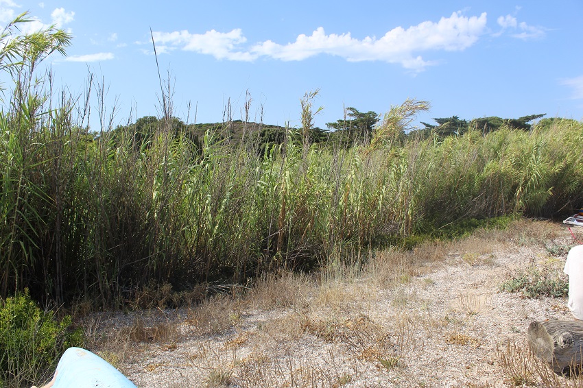
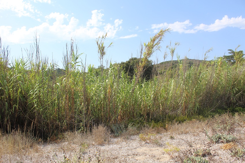
La zone se situe à l'ouest de Saint Florent, séparé de la plage par une route et un parking. La végétation de la zone est majoritairement composée de salicornes et de joncs, et des tamaris sont présents sur les bordures de la zone.
Wetland data
Basic information
| Wetland location: | Marine / Coastal |
| Wetland type: | Natural |
| Wetland area: | 0.4 Ha |
| Hydrological interaction: | - |
| Water salinity: | Brackish (0.5 - 18.0 g/l) |
| Type of fresh water input: | Catchment area (precipitation) |
| Surface water runoff | Outflow from lakeshore or river |
| Open water area (%): | < 5 |
| Hydroperiod: | Seasonal |
Geographic information
| Region: | Corsica |
| Sub region: | Sartène |
| Island: | Corsica |
| Municipality: | Bonifacio |
| Longitude: | 9.239753 East |
| Latitude: | 41.398372 North |
Wetland condition
| Wetland status (MEDWET): | 3 - Original habitats / landform partially modified (10-50% untouched) |
Ramsar wetland type
| Type | Coverage (%) |
| F -- Estuarine waters; permanent water of estuaries and estuarine systems of deltas | > 95 |
Property status
| Private |
| Protection status category | Protection status subcategory | Area's name | Code | Coverage area (%) | Legislation |
| International Protection | Special Protection Area (SPA) | Lavezzi Islands, Bouches of Bonifacio | FR9410021 | 8 | D 95-631/05.05.95 |
IUCN protection status
| IUCN code | IUCN Category |
| IV | Aire de gestion des habitats ou espèces |
| V | Paysage terrestre ou marin protégé |
Ecosystem services
| Type of ecosystem service | Ecosystem service | Scale of Βenefit (%) | Importance |
| Regulatory services | Visual buffering | Local (<2km) | 1 - 1000 people benefitting |
| Regulatory services | Noise buffering | Local (<2km) | 1 - 1000 people benefitting |
Activities on wetland
| Activity | Intensity |
| 401 = continuous urbanisation | Medium |
| 954 = invasion by a species | Medium |
Activities on catchment area
| Activity | Intensity |
| 140 = Grazing | Unknown |
| 220 = Leisure fishing | Low |
| 230 = Hunting | Unknown |
| 401 = continuous urbanisation | High |
| 501 = paths tracks cycling tracks | Low |
| 502 = roads motorways | Low |
| 530 = Improved access to site | Medium |
| 621 = nautical sports | Medium |
Impacts
| Impact | Intensity |
| HF- = Habitat fragmentation | Medium |
| HL- = Habitat loss | Medium |
| VCX = Introduction of exotic floral species | High |
Vegetation types
| Type | Coverage (%) |
| Shrubby / Arborescent | 5 - 25 |
| Emergent | 51 - 75 |
Flora
| Species | Presence status | References |
| Ammophila arenaria (L.) Link, 1827 | Present | |
| Arundo donax L., 1753 | Present | |
| Glaucium flavum Crantz, 1763 | Present | |
| Matthiola sinuata (L.) W.T.Aiton, 1812 | Present | |
| Pancratium maritimum L., 1753 | Present | |
| Pistacia lentiscus L., 1753 | Present | |
| Plantago coronopus L., 1753 | Present |
BirdLife International (2021) Important Bird Areas factsheet: Forêts domaniales de Corse. Downloaded from http://www.birdlife.org on 18/08/2021.
BirdLife International (2021) Important Bird Areas factsheet: Golfe de Porto, presqu'île de Scandola et golfe de Galeria. Downloaded from http://www.birdlife.org on 18/08/2021.
BirdLife International (2021) Important Bird Areas factsheet: Iles Cerbicale. Downloaded from http://www.birdlife.org on 18/08/2021.
Images