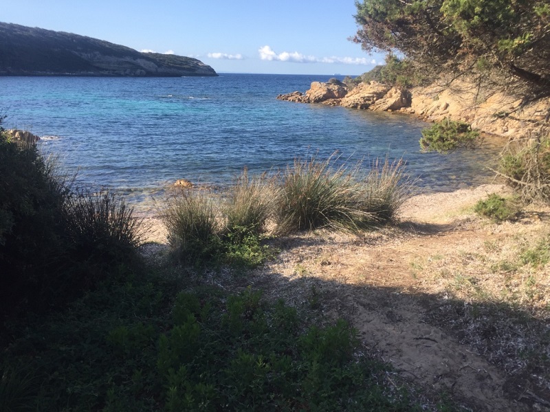
FR831COR202 - Estuaire de Finosa
Wetland data
Basic information
| Wetland location: |
Marine / Coastal |
| Wetland type: |
Natural |
| Wetland area: |
0.1 Ha |
| Hydrological interaction: |
- |
| Water salinity: |
Brackish (0.5 - 18.0 g/l) |
| Type of fresh water input: |
Catchment area (precipitation) |
| Surface water runoff |
Outflow from lakeshore or river |
| Open water area (%): |
26 - 50 |
| Hydroperiod: |
Temporary / Intermittent |
Geographic information
| Region: |
Corsica |
| Sub region: |
Sartène |
| Island: |
Corsica |
| Municipality: |
Bonifacio |
| Longitude: |
9.129905 East |
| Latitude: |
41.399710 North |
Wetland condition
| Wetland status (MEDWET): |
1 - Untouched. No signs of man-made changes |
Ramsar wetland type
| Type |
Coverage (%) |
| F -- Estuarine waters; permanent water of estuaries and estuarine systems of deltas |
> 95 |
Property status
| Conservatoire du littoral |
Protection statuses
| Protection status category |
Protection status subcategory |
Area's name |
Code |
Coverage area (%) |
Legislation |
| Other |
ZNIEFF type I |
MASSIF DE LA TRINITE |
|
100 |
|
CDDA protection status
| CDDA code |
CDDA category |
| FR13 |
Site/Monument Classified |
IUCN protection status
| IUCN code |
IUCN Category |
| III |
Monument ou élément naturel |
Ecosystem services
| Type of ecosystem service |
Ecosystem service |
Scale of Βenefit (%) |
Importance |
| Regulatory services |
Air quality regulation |
Local (<2km) |
1 - 1000 people benefitting |
| Regulatory services |
Local climate regulation |
Local (<2km) |
1 - 1000 people benefitting |
| Regulatory services |
Erosion regulation |
Local (<2km) |
1 - 1000 people benefitting |
| Cultural services |
Recreation and tourism |
Local (<2km) |
Significant and/or >1000 people benefitting |
| Cultural services |
Social relations |
Local (<2km) |
Significant and/or >1000 people benefitting |
Activities on wetland
| Activity |
Intensity |
| 010 = Habitat conservation |
High |
| 020 = Resource conservation |
High |
| 030 = Species conservation |
High |
| 230 = Hunting |
High |
| 501 = paths tracks cycling tracks |
Medium |
| 507 = bridge viaduct |
Medium |
| 530 = Improved access to site |
Medium |
| 622 = walking horseriding and non-motorised vehicles |
Medium |
Activities on catchment area
| Activity |
Intensity |
| 010 = Habitat conservation |
High |
| 020 = Resource conservation |
High |
| 030 = Species conservation |
High |
| 100 = Cultivation |
Medium |
| 210 = Professional fishing |
Unknown |
| 220 = Leisure fishing |
Unknown |
| 230 = Hunting |
High |
| 403 = dispersed habitation |
Medium |
| 423 = disposal of inert materials |
Low |
| 501 = paths tracks cycling tracks |
Medium |
| 502 = roads motorways |
Medium |
| 507 = bridge viaduct |
Medium |
| 530 = Improved access to site |
Medium |
| 608 = camping and caravans |
Low |
| 620 = Outdoor sports and leisure activities |
High |
| 621 = nautical sports |
High |
| 622 = walking horseriding and non-motorised vehicles |
High |
| 625 = gliding delta plane paragliding ballooning |
Medium |
Impacts
| Impact |
Intensity |
| EF- = Increase in protection from natural forces |
High |
| EP- = Reduction of salt intrusion potential |
High |
| ER- = Increase in flow regulation |
High |
| EU- = Increase of tourist/recreation potential |
High |
Vegetation types
| Type |
Coverage (%) |
| Shrubby / Arborescent |
5 - 25 |
| Emergent |
51 - 75 |
| Ammophilous |
5 - 25 |
Flora
| Species |
Presence status |
References |
| Carpobrotus acinaciformis (L.) L.Bolus, 1927 |
Present |
DOCOB Natura 2000 n° FR9400592 - « Ve... |
| Dittrichia viscosa (L.) Greuter, 1973 |
Present |
|
| Juncus acutus L., 1753 |
Present |
|
| Juniperus phoenicea L., 1753 |
Present |
|
| Rubus sp. L., 1753 |
Present |
|