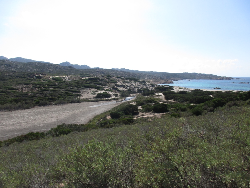
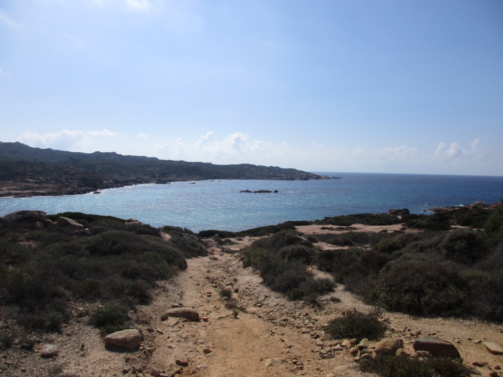
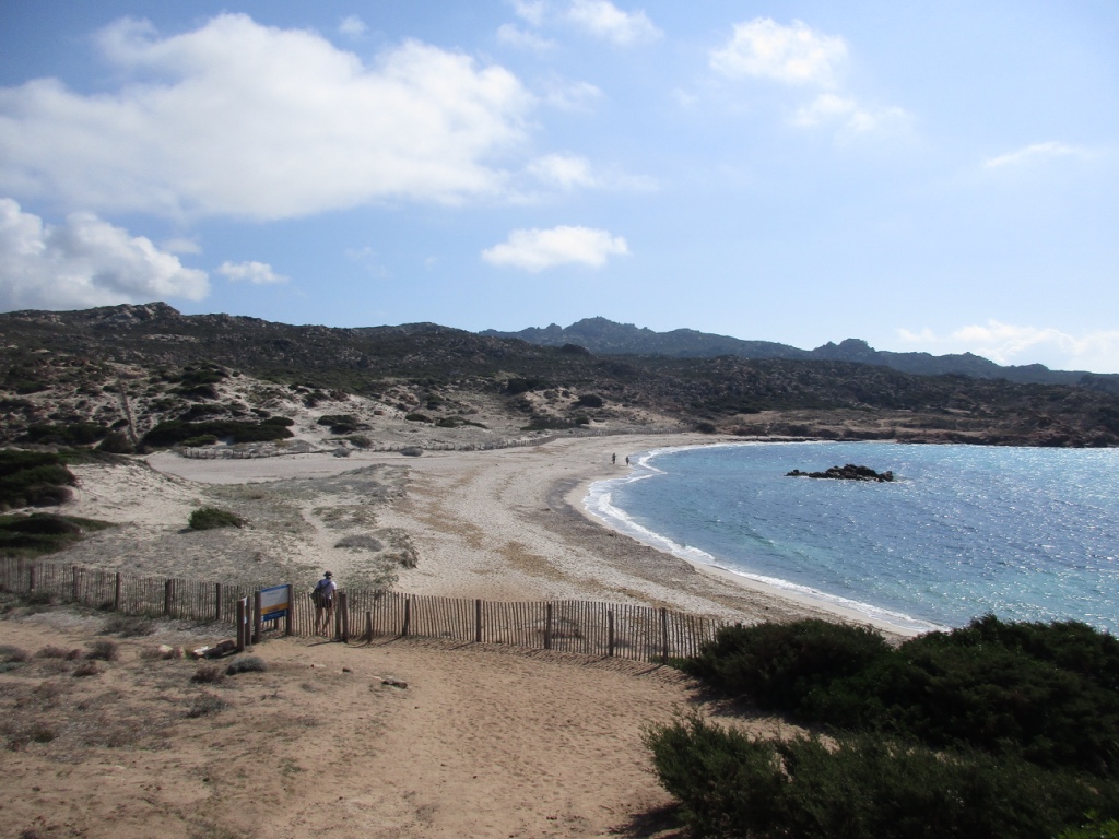
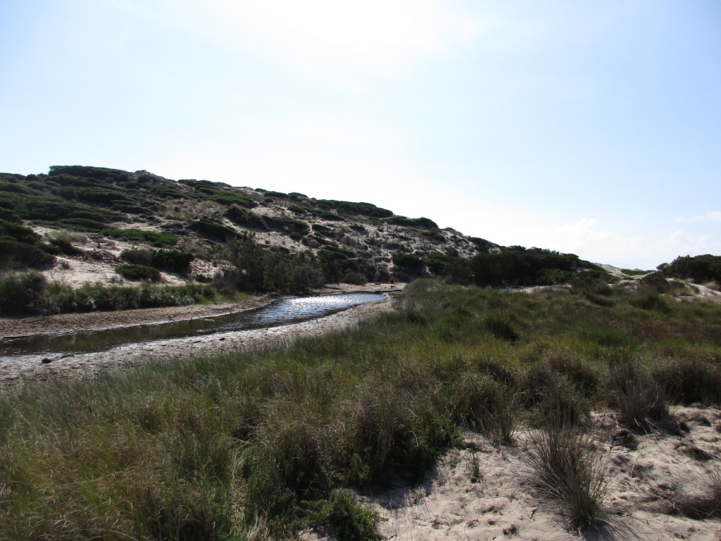
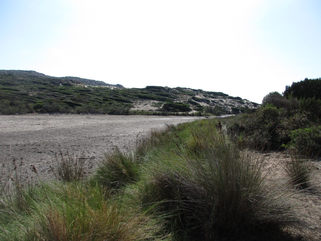
FR831COR203 - Estuaire du Stagnolu
Wetland data
Basic information
| Wetland location: |
Marine / Coastal |
| Wetland type: |
Natural |
| Wetland area: |
2.0 Ha |
| Hydrological interaction: |
- |
| Water salinity: |
Brackish (0.5 - 18.0 g/l) |
| Type of fresh water input: |
Torrent / Stream - Unconfined aquifer |
| Surface water runoff |
Outflow from lakeshore or river |
| Open water area (%): |
51 - 75 |
| Hydroperiod: |
Permanent |
Geographic information
| Region: |
Corsica |
| Sub region: |
Sartène |
| Island: |
Corsica |
| Municipality: |
Bonifacio |
| Longitude: |
9.111139 East |
| Latitude: |
41.422554 North |
Wetland condition
| Wetland status (MEDWET): |
2 - Original habitats / landform still predominant (>50%) |
Ramsar wetland type
| Type |
Coverage (%) |
| F -- Estuarine waters; permanent water of estuaries and estuarine systems of deltas |
5 - 25 |
| J -- Coastal brackish/saline lagoons; brackish to saline lagoons with at least one relatively narrow connection to the sea |
76 - 95 |
Property status
| Conservatoire du littoral |
Protection statuses
| Protection status category |
Protection status subcategory |
Area's name |
Code |
Coverage area (%) |
Legislation |
| National/Regional Protection |
Land acquired by the Conservatoire du littoral |
TESTA - VENTILEGNE |
|
70 |
L.322-1 Code Env. |
| Other |
ZNIEFF type I |
MASSIF DE LA TRINITE |
|
61 |
|
| Other |
ZNIEFF type I |
zones sableuses de la tonnara et du littoral d’Erbaiolu/Bonifacio |
|
34 |
|
| International Protection |
Special Area of Conservation (SAC) |
Ventilegne-la Trinite de Bonifacio-Fazzio |
FR9400592 |
100 |
D 95-631/05.05.95 |
CDDA protection status
| CDDA code |
CDDA category |
| FR13 |
Site/Monument Classified |
| FR14 |
Site acquired by the Conservatoire du littoral |
IUCN protection status
| IUCN code |
IUCN Category |
| III |
Monument ou élément naturel |
| IV |
Aire de gestion des habitats ou espèces |
| V |
Paysage terrestre ou marin protégé |
Ecosystem services
| Type of ecosystem service |
Ecosystem service |
Scale of Βenefit (%) |
Importance |
| Provisioning services |
Fresh water |
Local (<2km) |
1 - 1000 people benefitting |
| Provisioning services |
Food |
Local (<2km) |
1 - 1000 people benefitting |
| Regulatory services |
Air quality regulation |
Local (<2km) |
Significant and/or >1000 people benefitting |
| Regulatory services |
Local climate regulation |
Local (<2km) |
Significant and/or >1000 people benefitting |
| Regulatory services |
Water regulation |
Local (<2km) |
Gaps in evidence |
| Regulatory services |
Erosion regulation |
Local (<2km) |
Significant and/or >1000 people benefitting |
| Regulatory services |
Water purification |
Local (<2km) |
1 - 1000 people benefitting |
| Regulatory services |
Salinity regulation |
Local (<2km) |
Significant and/or >1000 people benefitting |
| Regulatory services |
Noise buffering |
Local (<2km) |
1 - 1000 people benefitting |
| Cultural services |
Recreation and tourism |
Local (<2km) |
Significant and/or >1000 people benefitting |
| Cultural services |
Aesthetic value |
Local (<2km) |
Significant and/or >1000 people benefitting |
| Cultural services |
Social relations |
Local (<2km) |
Significant and/or >1000 people benefitting |
| Supporting services |
Provision of habitat |
Local (<2km) |
Significant and/or >1000 people benefitting |
| Cultural services |
Recreation and tourism |
Island |
Significant and/or >1000 people benefitting |
| Cultural services |
Aesthetic value |
Island |
Significant and/or >1000 people benefitting |
| Cultural services |
Social relations |
Island |
Significant and/or >1000 people benefitting |
Activities on wetland
| Activity |
Intensity |
| 010 = Habitat conservation |
High |
| 030 = Species conservation |
High |
| 040 = Land restoration |
Unknown |
| 140 = Grazing |
Medium |
| 421 = disposal of household waste |
Low |
| 501 = paths tracks cycling tracks |
Medium |
| 502 = roads motorways |
Medium |
| 530 = Improved access to site |
Medium |
| 620 = Outdoor sports and leisure activities |
High |
| 621 = nautical sports |
High |
| 622 = walking horseriding and non-motorised vehicles |
High |
| 624 = mountaineering rock climbing speleology |
High |
| 871 = sea defense or coast protection works |
Medium |
Activities on catchment area
| Activity |
Intensity |
| 010 = Habitat conservation |
High |
| 030 = Species conservation |
High |
| 040 = Land restoration |
Unknown |
| 140 = Grazing |
Medium |
| 180 = Burning |
High |
| 210 = Professional fishing |
Unknown |
| 220 = Leisure fishing |
Medium |
| 403 = dispersed habitation |
Low |
| 501 = paths tracks cycling tracks |
Medium |
| 502 = roads motorways |
Medium |
| 530 = Improved access to site |
Medium |
| 608 = camping and caravans |
Low |
| 620 = Outdoor sports and leisure activities |
High |
| 621 = nautical sports |
High |
| 622 = walking horseriding and non-motorised vehicles |
High |
| 624 = mountaineering rock climbing speleology |
High |
| 871 = sea defense or coast protection works |
Medium |
Impacts
| Impact |
Intensity |
| EB- = Increase in aesthetic qualities |
High |
| EE- = Increase of economic potential |
High |
| EF- = Increase in protection from natural forces |
Unknown |
| EP- = Reduction of salt intrusion potential |
Medium |
| ER- = Increase in flow regulation |
Low |
| EU- = Increase of tourist/recreation potential |
Medium |
Habitat types
| Type |
Coverage (%) |
| 1150 * Coastal lagoons |
> 95 |
| 2110 Embryonic shifting dunes |
< 5 |
| 2250 * Coastal dunes with Juniperus spp |
< 5 |
| 92D0 Southern riparian galleries and thickets (Nerio-Tamaricetea and Securinegion tinctoriae) |
< 5 |
Vegetation types
| Type |
Coverage (%) |
| Shrubby / Arborescent |
5 - 25 |
| Emergent |
51 - 75 |
| Floating-leaved |
26 - 50 |
| Halophytic |
51 - 75 |
| Ammophilous |
51 - 75 |
Flora
| Species |
Presence status |
References |
| Ammophila arenaria (L.) Link, 1827 |
Present |
|
| Carpobrotus sp. N.E.Br., 1925 |
Present |
|
| Cistus salviifolius L., 1753 |
Present |
|
| Cotula coronopifolia L., 1753 |
Present |
DOCOB Natura 2000 n° FR9400592 - « Ve... |
| Cytisus spinosus (L.) Bubani, 1899 |
Present |
|
| Dittrichia viscosa (L.) Greuter, 1973 |
Present |
|
| Juncus acutus L., 1753 |
Present |
|
| Juniperus communis subsp. nana (Hook.) Syme, 1868 |
Present |
|
| Linaria flava subsp. sardoa (Sommier) A.Terracc., 1930 |
Present |
DOCOB Natura 2000 n° FR9400592 - « Ve... |
| Pistacia lentiscus L., 1753 |
Present |
|
| Schoenus nigricans L., 1753 |
Present |
|
| Scirpoides holoschoenus (L.) Soják, 1972 |
Present |
|
| Tamarix africana Poir., 1789 |
Present |
|
Fauna
Reptiles |
Presence status in wetland |
|
References |
| Emys orbicularis (Linnaeus, 1758) |
Present |
|
Fleuriau & Bosc (2013) - Etude de la ... |