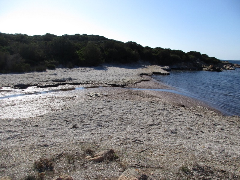
FR831COR204 - Estuaire du Cana d'Alta
Wetland data
Basic information
| Wetland location: |
Marine / Coastal |
| Wetland type: |
Natural |
| Wetland area: |
0.3 Ha |
| Hydrological interaction: |
- |
| Water salinity: |
Brackish (0.5 - 18.0 g/l) |
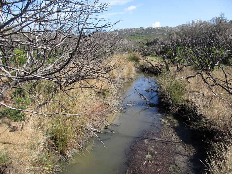
| Type of fresh water input: |
Torrent / Stream - Unconfined aquifer |
| Surface water runoff |
Outflow from lakeshore or river |
| Open water area (%): |
51 - 75 |
| Hydroperiod: |
Permanent |
Geographic information
| Region: |
Corsica |
| Sub region: |
Sartène |
| Island: |
Corsica |
| Municipality: |
Bonifacio |
| Longitude: |
9.118521 East |
| Latitude: |
41.433766 North |
Wetland condition
| Wetland status (MEDWET): |
2 - Original habitats / landform still predominant (>50%) |
Ramsar wetland type
| Type |
Coverage (%) |
| F -- Estuarine waters; permanent water of estuaries and estuarine systems of deltas |
> 95 |
Property status
| Conservatoire du littoral |
Protection statuses
| Protection status category |
Protection status subcategory |
Area's name |
Code |
Coverage area (%) |
Legislation |
| National/Regional Protection |
Corsican Natural Reserve |
Bouches de Bonifacio |
|
48 |
L.332-1 à L.332-27 Code Env. |
| National/Regional Protection |
Land acquired by the Conservatoire du littoral |
TESTA - VENTILEGNE |
|
62 |
L.322-1 Code Env. |
| Other |
ZNIEFF type I |
zones sableuses de la tonnara et du littoral d’Erbaiolu/Bonifacio |
|
66 |
|
| International Protection |
Special Protection Area (SPA) |
Lavezzi Islands, Bouches of Bonifacio |
FR9410021 |
1 |
D 95-631/05.05.95 |
| International Protection |
Special Area of Conservation (SAC) |
Ventilegne-la Trinite de Bonifacio-Fazzio |
FR9400592 |
99 |
D 95-631/05.05.95 |
| International Protection |
Special Area of Conservation (SAC) |
Bouches de Bonifacio, Islands of the Monks |
FR9402015 |
1 |
D 95-631/05.05.95 |
CDDA protection status
| CDDA code |
CDDA category |
| FR04 |
Regional Natural Reserve |
| FR14 |
Site acquired by the Conservatoire du littoral |
IUCN protection status
| IUCN code |
IUCN Category |
| IV |
Aire de gestion des habitats ou espèces |
| V |
Paysage terrestre ou marin protégé |
Ecosystem services
| Type of ecosystem service |
Ecosystem service |
Scale of Βenefit (%) |
Importance |
| Provisioning services |
Fresh water |
Local (<2km) |
Gaps in evidence |
| Provisioning services |
Food |
Local (<2km) |
Gaps in evidence |
| Regulatory services |
Air quality regulation |
Local (<2km) |
Significant and/or >1000 people benefitting |
| Regulatory services |
Local climate regulation |
Local (<2km) |
Significant and/or >1000 people benefitting |
| Regulatory services |
Water regulation |
Local (<2km) |
Significant and/or >1000 people benefitting |
| Regulatory services |
Erosion regulation |
Local (<2km) |
Significant and/or >1000 people benefitting |
| Regulatory services |
Water purification |
Local (<2km) |
Significant and/or >1000 people benefitting |
| Regulatory services |
Salinity regulation |
Local (<2km) |
Significant and/or >1000 people benefitting |
| Cultural services |
Recreation and tourism |
Local (<2km) |
Significant and/or >1000 people benefitting |
| Cultural services |
Recreation and tourism |
Island |
Significant and/or >1000 people benefitting |
| Cultural services |
Aesthetic value |
Local (<2km) |
Significant and/or >1000 people benefitting |
| Cultural services |
Aesthetic value |
Island |
Significant and/or >1000 people benefitting |
| Cultural services |
Social relations |
Local (<2km) |
Significant and/or >1000 people benefitting |
| Cultural services |
Social relations |
Island |
Significant and/or >1000 people benefitting |
| Supporting services |
Water recycling |
Local (<2km) |
Significant and/or >1000 people benefitting |
| Supporting services |
Provision of habitat |
Local (<2km) |
Significant and/or >1000 people benefitting |
Activities on wetland
| Activity |
Intensity |
| 010 = Habitat conservation |
High |
| 030 = Species conservation |
High |
| 140 = Grazing |
Medium |
| 210 = Professional fishing |
Unknown |
| 220 = Leisure fishing |
Unknown |
| 230 = Hunting |
Medium |
| 403 = dispersed habitation |
Low |
| 501 = paths tracks cycling tracks |
Medium |
| 507 = bridge viaduct |
Low |
| 530 = Improved access to site |
High |
| 622 = walking horseriding and non-motorised vehicles |
High |
| 948 = fire (natural) |
High |
Activities on catchment area
| Activity |
Intensity |
| 010 = Habitat conservation |
High |
| 030 = Species conservation |
High |
| 140 = Grazing |
Medium |
| 210 = Professional fishing |
Unknown |
| 220 = Leisure fishing |
Unknown |
| 230 = Hunting |
Medium |
| 403 = dispersed habitation |
Low |
| 419 = other industrial / commercial areas |
Medium |
| 501 = paths tracks cycling tracks |
Medium |
| 502 = roads motorways |
Medium |
| 507 = bridge viaduct |
Low |
| 530 = Improved access to site |
High |
| 608 = camping and caravans |
Low |
| 621 = nautical sports |
High |
| 622 = walking horseriding and non-motorised vehicles |
High |
| 625 = gliding delta plane paragliding ballooning |
High |
| 948 = fire (natural) |
High |
Impacts
| Impact |
Intensity |
| ED- = Increase in sediment removal/retention |
High |
| EP- = Reduction of salt intrusion potential |
High |
| ER- = Increase in flow regulation |
Medium |
| EU- = Increase of tourist/recreation potential |
Unknown |
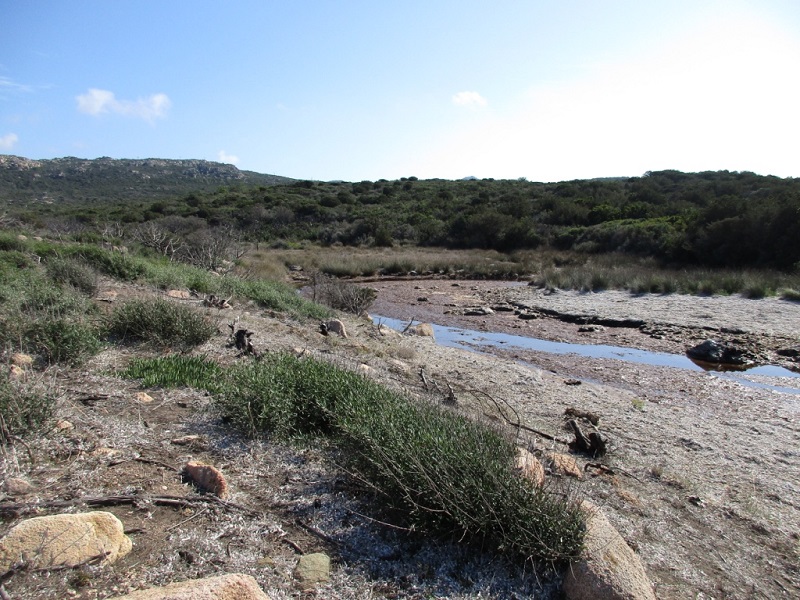
Vegetation types
| Type |
Coverage (%) |
| Shrubby / Arborescent |
< 5 |
| Emergent |
26 - 50 |
| Halophytic |
26 - 50 |
| Ammophilous |
5 - 25 |
Flora
| Species |
Presence status |
References |
| Carpobrotus sp. N.E.Br., 1925 |
Present |
|
| Cistus salviifolius L., 1753 |
Present |
|
| Juncus acutus L., 1753 |
Present |
|
| Pistacia lentiscus L., 1753 |
Present |
|
| Tamarix africana Poir., 1789 |
Present |
|