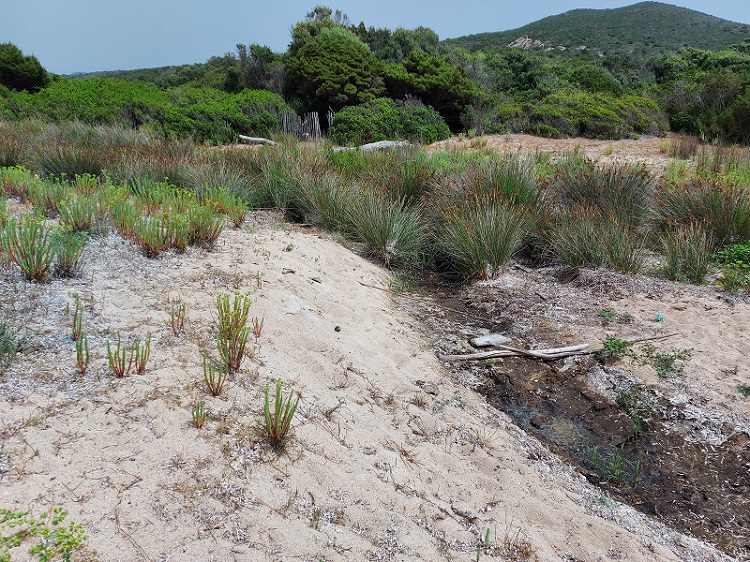
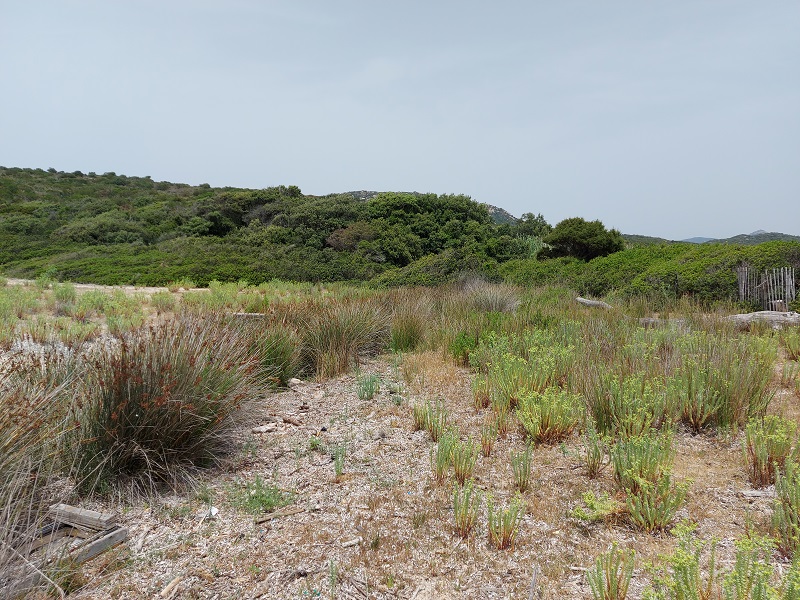
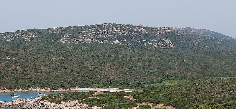
FR831COR271 - Estuaire de l'Aulleca
Wetland data
Basic information
| Wetland location: |
Marine / Coastal |
| Wetland type: |
Natural |
| Wetland area: |
4.8 Ha |
| Hydrological interaction: |
- |
| Water salinity: |
Brackish (0.5 - 18.0 g/l) |
| Type of fresh water input: |
Torrent / Stream - Unconfined aquifer |
| Surface water runoff |
Outflow from lakeshore or river |
| Open water area (%): |
< 5 |
| Hydroperiod: |
Seasonal |
Geographic information
| Region: |
Corsica |
| Sub region: |
Sartène |
| Island: |
Corsica |
| Municipality: |
Sartène |
| Longitude: |
8.806621 East |
| Latitude: |
41.576076 North |
Wetland condition
| Wetland status (MEDWET): |
2 - Original habitats / landform still predominant (>50%) |
Ramsar wetland type
| Type |
Coverage (%) |
| F -- Estuarine waters; permanent water of estuaries and estuarine systems of deltas |
> 95 |
Property status
| Conservatoire du littoral |
Protection statuses
| Protection status category |
Protection status subcategory |
Area's name |
Code |
Coverage area (%) |
Legislation |
| National/Regional Protection |
Land acquired by the Conservatoire du littoral |
CAMPUMORU - SENETOSA |
|
68 |
L.322-1 Code Env. |
| Other |
ZNIEFF type I |
PUNTA DI CAMPOMORU - CAPU DI SENETOSA |
|
100 |
|
| International Protection |
Special Area of Conservation (SAC) |
Campomoro-Senetosa |
FR9402001 |
35 |
D 95-631/05.05.95 |
CDDA protection status
| CDDA code |
CDDA category |
| FR14 |
Site acquired by the Conservatoire du littoral |
IUCN protection status
| IUCN code |
IUCN Category |
| IV |
Aire de gestion des habitats ou espèces |
| V |
Paysage terrestre ou marin protégé |
Activities on wetland
| Activity |
Intensity |
| 010 = Habitat conservation |
High |
| 020 = Resource conservation |
High |
| 030 = Species conservation |
High |
| 040 = Land restoration |
High |
| 140 = Grazing |
Low |
| 180 = Burning |
Low |
| 421 = disposal of household waste |
Medium |
| 501 = paths tracks cycling tracks |
Low |
| 530 = Improved access to site |
Medium |
| 954 = invasion by a species |
Low |
Activities on catchment area
| Activity |
Intensity |
| 010 = Habitat conservation |
High |
| 020 = Resource conservation |
High |
| 030 = Species conservation |
High |
| 040 = Land restoration |
High |
| 140 = Grazing |
Low |
| 501 = paths tracks cycling tracks |
Low |
| 530 = Improved access to site |
Medium |
| 622 = walking horseriding and non-motorised vehicles |
Low |
| 624 = mountaineering rock climbing speleology |
Low |
Impacts
| Impact |
Intensity |
| ER- = Increase in flow regulation |
High |
| ET- = Increase in toxicant removal/retention |
High |
Habitat types
| Type |
Coverage (%) |
| 1410 Mediterranean salt meadows (Juncetalia maritimi) |
< 5 |
| 1420 Mediterranean and thermo-Atlantic halophilous scrubs (Sarcocornetea fruticosi) |
< 5 |
| 2110 Embryonic shifting dunes |
< 5 |
| 2230 Malcolmietalia dune grasslands |
< 5 |
| 5210 Arborescent matorral with Juniperus spp. |
5 - 25 |
| 92D0 Southern riparian galleries and thickets (Nerio-Tamaricetea and Securinegion tinctoriae) |
< 5 |
Vegetation types
| Type |
Coverage (%) |
| Shrubby / Arborescent |
5 - 25 |
| Other |
51 - 75 |
| Emergent |
26 - 50 |
Flora
| Species |
Presence status |
References |
| Convolvulus soldanella L., 1753 |
Present |
|
| Dittrichia viscosa (L.) Greuter, 1973 |
Present |
|
| Eryngium maritimum L., 1753 |
Present |
|
| Juncus acutus L., 1753 |
Present |
|
| Juncus effusus L., 1753 |
Present |
|
| Juniperus phoenicea L., 1753 |
Present |
|
| Phragmites australis (Cav.) Trin. ex Steud., 1840 |
Present |
|
| Pistacia lentiscus L., 1753 |
Present |
|
| Plantago coronopus L., 1753 |
Present |
|
| Quercus ilex L., 1753 |
Present |
|
| Rubus sp. L., 1753 |
Present |
|
| Smilax aspera L., 1753 |
Present |
|
Fauna
Birds |
Number of individuals |
Nesting |
References |
| Milvus milvus (Linnaeus, 1758) |
|
|
|