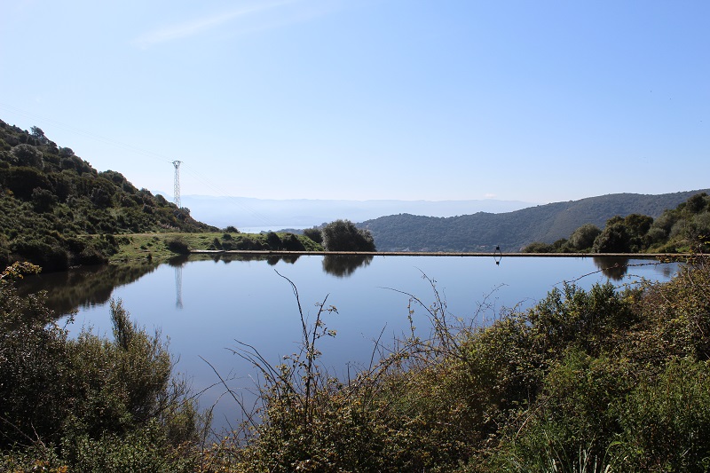
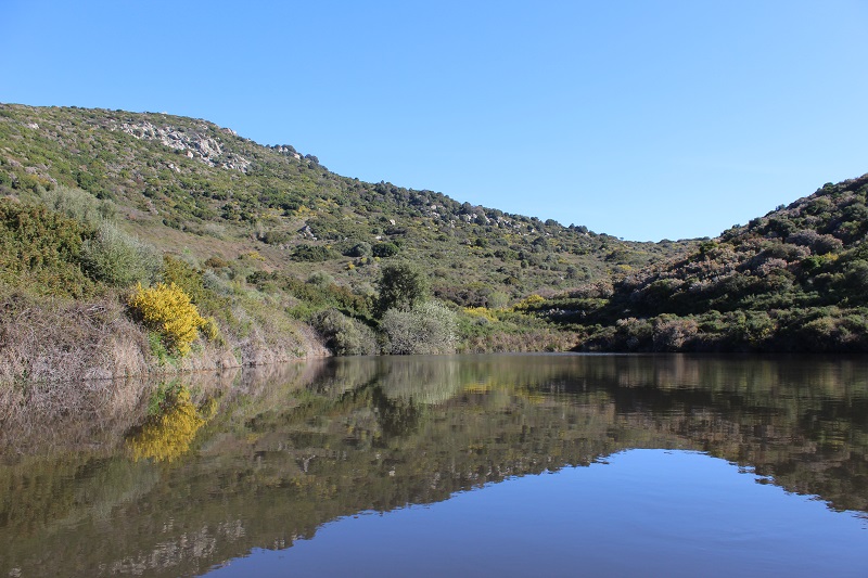
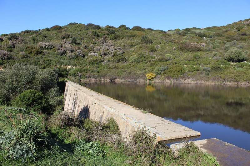
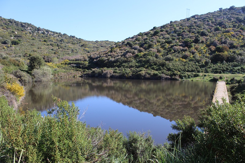
FR832COR311 - Lac de barrage de Lisa
Description

Wetland data
Basic information
| Wetland location: | Inland |
| Wetland type: | Artificial |
| Wetland area: | 0.5 Ha |
| Hydrological interaction: | - |
| Water salinity: | Fresh (< 0.5 g/l) |
| Type of fresh water input: | Torrent / Stream - Unconfined aquifer |
| Surface water runoff | Outflow controlled by dam |
| Open water area (%): | > 95 |
| Hydroperiod: | Permanent |
Geographic information
| Region: | Corsica |
| Sub region: | Ajaccio |
| Island: | Corsica |
| Municipality: | Ajaccio |
| Longitude: | 8.703311 East |
| Latitude: | 41.938926 North |
Biological significance
| Biological significance: | Medium |
Ramsar wetland type
| Type | Coverage (%) |
| 6 -- Water storage areas; reservoirs/barrages/dams/impoundments (generally over 8 ha) | > 95 |
Property status
| Government - Municipal |
| Protection status category | Protection status subcategory | Area's name | Code | Coverage area (%) | Legislation |
| Other | ZNIEFF type I | PUNTA DI LISA – MONTE POZZO DI BORGO | 100 |
Ecosystem services
| Type of ecosystem service | Ecosystem service | Scale of Βenefit (%) | Importance |
| Provisioning services | Fresh water | Local (<2km) | 1 - 1000 people benefitting |
| Provisioning services | Food | Local (<2km) | 1 - 1000 people benefitting |
| Regulatory services | Air quality regulation | Local (<2km) | 1 - 1000 people benefitting |
| Regulatory services | Local climate regulation | Local (<2km) | 1 - 1000 people benefitting |
| Regulatory services | Water regulation | Local (<2km) | 1 - 1000 people benefitting |
| Regulatory services | Fire regulation | Local (<2km) | 1 - 1000 people benefitting |
| Cultural services | Recreation and tourism | Local (<2km) | Significant and/or >1000 people benefitting |
| Cultural services | Social relations | Local (<2km) | Significant and/or >1000 people benefitting |
| Supporting services | Water recycling | Local (<2km) | 1 - 1000 people benefitting |
| Supporting services | Provision of habitat | Local (<2km) | 1 - 1000 people benefitting |
Activities on wetland
| Activity | Intensity |
| 220 = Leisure fishing | Unknown |
| 530 = Improved access to site | Medium |
| 810 = Drainage | Low |
| 870 = Dykes embankments artificial beaches general | High |
Activities on catchment area
| Activity | Intensity |
| 140 = Grazing | Low |
| 230 = Hunting | Medium |
| 402 = discontinuous urbanisation | Low |
| 501 = paths tracks cycling tracks | High |
| 502 = roads motorways | Low |
| 511 = electricity lines | Low |
| 530 = Improved access to site | Medium |
| 624 = mountaineering rock climbing speleology | Low |
| 954 = invasion by a species | Low |
Impacts
| Impact | Intensity |
| ER- = Increase in flow regulation | Unknown |
| ES- = Increase in water supply | Medium |
| EW- = Increase in wilderness/wildlife values | Low |
Vegetation types
| Type | Coverage (%) |
| Shrubby / Arborescent | 5 - 25 |
| Other | 51 - 75 |
| Emergent | < 5 |
| Floating-leaved | 5 - 25 |
| Wet meadow | < 5 |
Flora
| Species | Presence status | References |
| Asphodelus ramosus L., 1753 | Present | |
| Cistus monspeliensis L., 1753 | Present | |
| Dittrichia viscosa (L.) Greuter, 1973 | Present | |
| Erica arborea L., 1753 | Present | |
| Erica scoparia L., 1753 | Present | |
| Juncus sp. L., 1753 | Present | |
| Lavandula stoechas L., 1753 | Present | |
| Olea europaea L., 1753 | Present | |
| Pistacia lentiscus L., 1753 | Present | |
| Prunus spinosa L., 1753 | Present | |
| Quercus ilex L., 1753 | Present | |
| Rubus sp. L., 1753 | Present | |
| Vicia sp. L., 1753 | Present |
Fauna
Reptiles |
Presence status in wetland |
References |
|
| Emys orbicularis (Linnaeus, 1758) | Present | ||
Amphibians |
Presence status in wetland |
References |
|
| Pelophylax lessonae bergeri (Günther in Engelmann, Fritzsche, Günther & Obst, 1986) | Present | ||
Fishes |
Presence status in wetland |
References |
|
| Cyprinus carpio (Linnaeus, 1758) | Present | ||
Birds |
Number of individuals |
Nesting |
References |
| Sylvia atricapilla (Linnaeus, 1758) |
Images