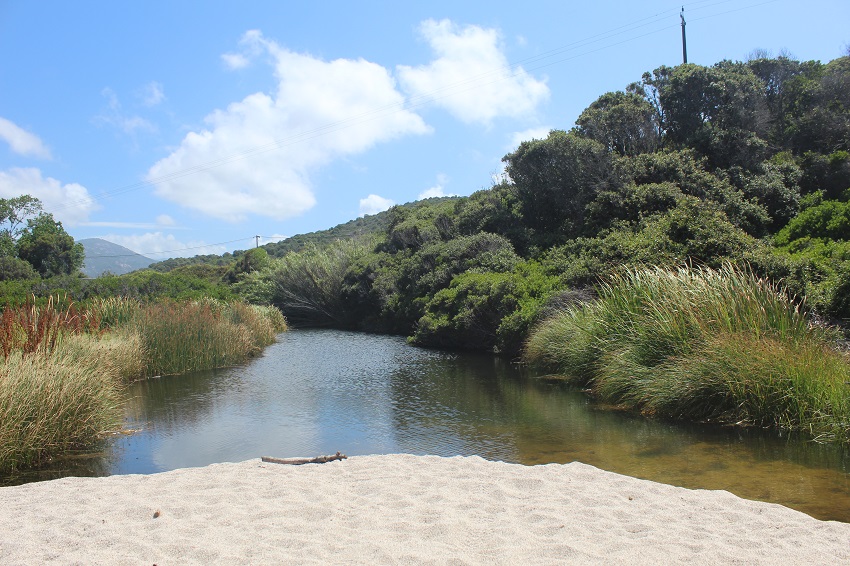
FR832COR329 - Embouchure du Bubia
Wetland data
Basic information
| Wetland location: |
Marine / Coastal |
| Wetland type: |
Natural |
| Wetland area: |
0.7 Ha |
| Hydrological interaction: |
- |
| Water salinity: |
Brackish (0.5 - 18.0 g/l) |
| Type of fresh water input: |
Torrent / Stream - Unconfined aquifer |
| Surface water runoff |
Outflow from lakeshore or river |
| Open water area (%): |
26 - 50 |
| Hydroperiod: |
Permanent |
Geographic information
| Region: |
Corsica |
| Sub region: |
Ajaccio |
| Island: |
Corsica |
| Municipality: |
Cargèse |
| Longitude: |
8.652105 East |
| Latitude: |
42.117480 North |
Wetland condition
| Wetland status (MEDWET): |
2 - Original habitats / landform still predominant (>50%) |
Ramsar wetland type
| Type |
Coverage (%) |
| F -- Estuarine waters; permanent water of estuaries and estuarine systems of deltas |
> 95 |
Property status
| Government - Municipal / Private |
Protection statuses
| Protection status category |
Protection status subcategory |
Area's name |
Code |
Coverage area (%) |
Legislation |
| National/Regional Protection |
Regional natural Park |
Corse |
|
46 |
L.333-1 à L.333-4 Code Env. |
| International Protection |
Biosphere Reserve (transition zone) |
Falasorma - Dui Sevi |
|
4 |
|
CDDA protection status
| CDDA code |
CDDA category |
| FR15 |
Regional Natural Park |
IUCN protection status
| IUCN code |
IUCN Category |
| V |
Paysage terrestre ou marin protégé |
Ecosystem services
| Type of ecosystem service |
Ecosystem service |
Scale of Βenefit (%) |
Importance |
| Regulatory services |
Air quality regulation |
Local (<2km) |
1 - 1000 people benefitting |
| Regulatory services |
Local climate regulation |
Local (<2km) |
1 - 1000 people benefitting |
| Cultural services |
Social relations |
Local (<2km) |
1 - 1000 people benefitting |
Activities on wetland
| Activity |
Intensity |
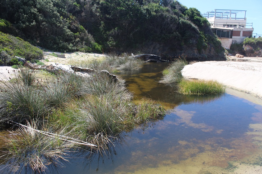
| 403 = dispersed habitation |
Low |
| 502 = roads motorways |
Medium |
| 507 = bridge viaduct |
Medium |
| 511 = electricity lines |
Low |
| 710 = Noise nuisance |
Low |
| 954 = invasion by a species |
High |
Activities on catchment area
| Activity |
Intensity |
| 220 = Leisure fishing |
Medium |
| 230 = Hunting |
Low |
| 403 = dispersed habitation |
Low |
| 502 = roads motorways |
Medium |
| 507 = bridge viaduct |
Medium |
| 511 = electricity lines |
Low |
| 530 = Improved access to site |
Medium |
| 621 = nautical sports |
High |
| 623 = motorised vehicles |
Medium |
| 954 = invasion by a species |
High |
Impacts
| Impact |
Intensity |
| HF- = Habitat fragmentation |
Low |
| VCD = Loss of floral diversity |
Medium |
| VCX = Introduction of exotic floral species |
Medium |
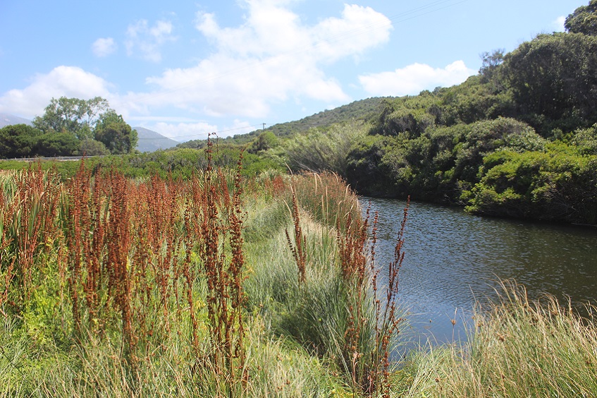
Vegetation types
| Type |
Coverage (%) |
| Shrubby / Arborescent |
26 - 50 |
| Emergent |
26 - 50 |
| Halophytic |
5 - 25 |
| Submerged |
< 5 |
Flora
| Species |
Presence status |
References |
| Arundo donax L., 1753 |
Present |
|
| Bolboschoenus maritimus (L.) Palla, 1905 |
Present |
|
| Cakile maritima Scop., 1772 |
Present |
|
| Carpobrotus sp. N.E.Br., 1925 |
Present |
|
| Convolvulus silvaticus Kit., 1805 |
Present |
|
| Crithmum maritimum L., 1753 |
Present |
|
| Elytrigia acuta (DC.) Tzvelev, 1973 |
Present |
|
| Eryngium maritimum L., 1753 |
Present |
|
| Juncus acutus L., 1753 |
Present |
|
| Pistacia lentiscus L., 1753 |
Present |
|
| Quercus ilex L., 1753 |
Present |
|
| Rumex sp. L., 1753 |
Present |
|
| Smilax aspera L., 1753 |
Present |
|
Fauna
Invertebrates |
Presence status in wetland |
|
References |
| Crocothemis erythraea (Brullé, 1832) |
Present |
|
|