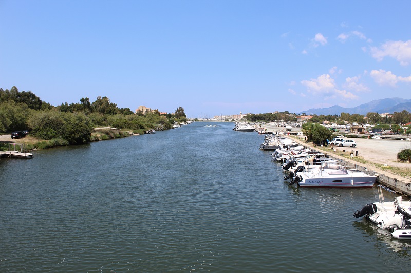
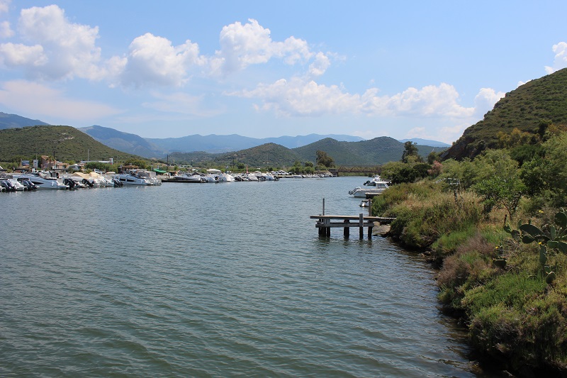
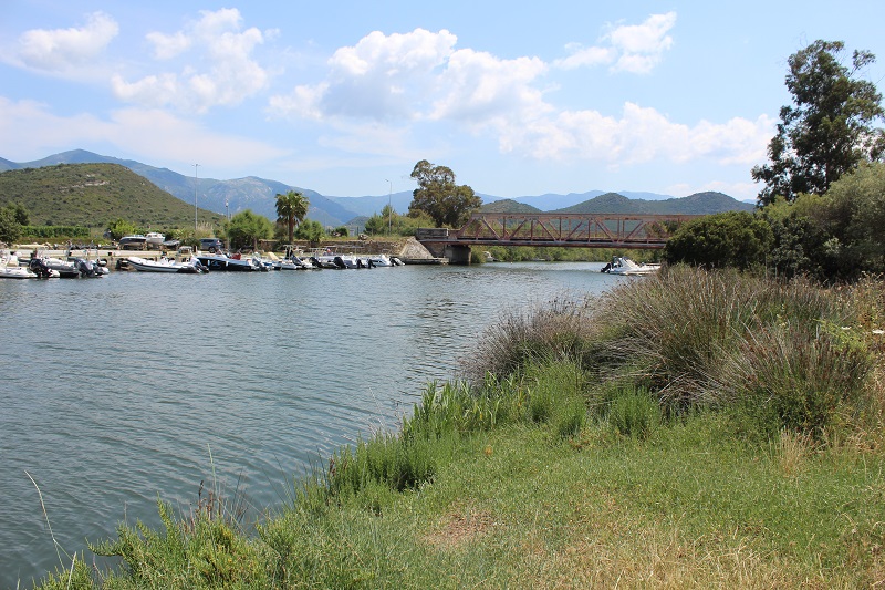
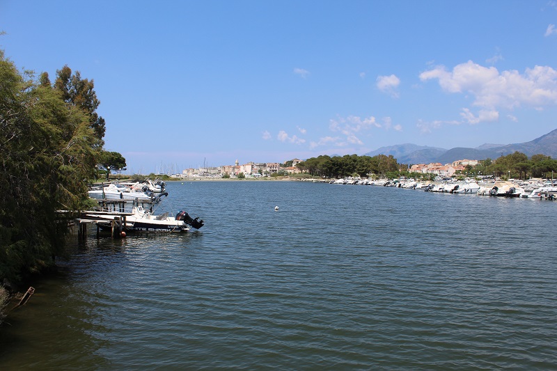
FR834COR382 - Embouchure de l'Aliso
Description

Wetland data
Basic information
| Wetland location: | Marine / Coastal |
| Wetland type: | Natural |
| Wetland area: | 7.3 Ha |
| Hydrological interaction: | - |
| Water salinity: | Brackish (0.5 - 18.0 g/l) |
| Type of fresh water input: | Torrent / Stream - Unconfined aquifer |
| Surface water runoff | Outflow from lakeshore or river |
| Open water area (%): | > 95 |
| Hydroperiod: | Permanent |
Geographic information
| Region: | Corsica |
| Sub region: | Calvi |
| Island: | Corsica |
| Municipality: | Saint-Florent |
| Longitude: | 9.300869 East |
| Latitude: | 42.675428 North |
Wetland condition
| Wetland status (MEDWET): | 5 - Original habitats / landform totally changed |
Ramsar wetland type
| Type | Coverage (%) |
| F -- Estuarine waters; permanent water of estuaries and estuarine systems of deltas | > 95 |
Property status
| Government - Municipal |
| Protection status category | Protection status subcategory | Area's name | Code | Coverage area (%) | Legislation |
| National/Regional Protection | Marine natural Park | Cap Corse et Agriate | 79 | L.334-3 à L.334-8 Code Env. |
CDDA protection status
| CDDA code | CDDA category |
| FR12 | Site/Monument Registered |
IUCN protection status
| IUCN code | IUCN Category |
| III | Monument ou élément naturel |
| V | Paysage terrestre ou marin protégé |
| VI | Aire protégée avec utilisation durable des ressources naturelles |
Activities on wetland
| Activity | Intensity |
| 220 = Leisure fishing | Medium |
| 501 = paths tracks cycling tracks | Low |
| 502 = roads motorways | Low |
| 504 = port areas | High |
| 507 = bridge viaduct | Low |
| 530 = Improved access to site | High |
| 623 = motorised vehicles | High |
| 701 = water pollution | Unknown |
| 710 = Noise nuisance | Medium |
| 850 = Modification of hydrographic functioning general | High |
| 870 = Dykes embankments artificial beaches general | High |
Activities on catchment area
| Activity | Intensity |
| 220 = Leisure fishing | Medium |
| 401 = continuous urbanisation | Medium |
| 410 = Industrial or commercial areas | Low |
| 501 = paths tracks cycling tracks | Low |
| 502 = roads motorways | Medium |
| 504 = port areas | High |
| 530 = Improved access to site | High |
| 608 = camping and caravans | High |
| 621 = nautical sports | High |
| 623 = motorised vehicles | High |
| 710 = Noise nuisance | Medium |
| 870 = Dykes embankments artificial beaches general | High |
Impacts
| Impact | Intensity |
| AN- = Increase in noise | Medium |
| AS- = Loss of scenic value | Low |
| HC- = Loss of wildlife corridor(s) | Low |
| HF- = Habitat fragmentation | High |
| HL- = Habitat loss | Low |
| PO- = Oil pollution | High |
| WR- = Altered flow regime | High |
Vegetation types
| Type | Coverage (%) |
| Shrubby / Arborescent | < 5 |
| Other | < 5 |
Flora
| Species | Presence status | References |
| Juncus sp. L., 1753 | Present | |
| Olea europaea L., 1753 | Present | |
| Phoenix canariensis hort. ex Chabaud, 1882 | Present | |
| Phragmites australis (Cav.) Trin. ex Steud., 1840 | Present | |
| Pistacia lentiscus L., 1753 | Present | |
| Ranunculus ophioglossifolius Vill., 1789 | Present | DREAL Corse (OGREVA) |
| Suaeda maritima (L.) Dumort., 1827 | Present | |
| Tamarix africana Poir., 1789 | Present |
Fauna
Reptiles |
Presence status in wetland |
References |
|
| Trachemys scripta elegans (Wied, 1839) | Present | DREAL Corse (OGREVA) | |
Amphibians |
Presence status in wetland |
References |
|
| Bufotes viridis (Laurenti, 1768) | Present | DREAL Corse (OGREVA) | |
Invertebrates |
Presence status in wetland |
References |
|
| Lestes virens (Charpentier, 1825) | Present | DREAL Corse (OGREVA) | |
Birds |
Number of individuals |
Nesting |
References |
| Pandion haliaetus (Linnaeus, 1758) | DREAL Corse (OGREVA) | ||
| Apus pallidus (Shelley, 1870) | DREAL Corse (OGREVA) | ||
| Columba livia (Gmelin, 1789) | DREAL Corse (OGREVA) | ||
| Merops apiaster (Linnaeus, 1758) | DREAL Corse (OGREVA) | ||
| Lanius senator (Linnaeus, 1758) | DREAL Corse (OGREVA) |
Images