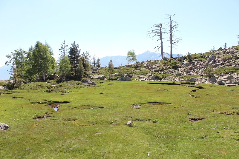
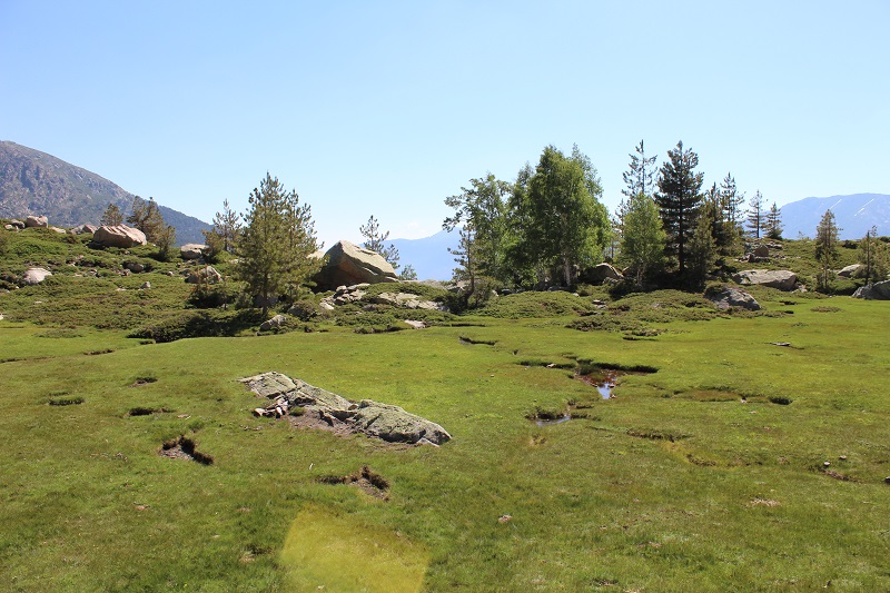
FR835COR413 - Prairie humide de Radule
Wetland data
Basic information
| Wetland location: |
Inland |
| Wetland type: |
Natural |
| Wetland area: |
0.4 Ha |
| Hydrological interaction: |
- |
| Water salinity: |
Fresh (< 0.5 g/l) |
| Type of fresh water input: |
Torrent / Stream - Unconfined aquifer |
| Surface water runoff |
Outflow from lakeshore or river |
| Open water area (%): |
5 - 25 |
| Hydroperiod: |
Seasonal |
Geographic information
| Region: |
Corsica |
| Sub region: |
Corte |
| Island: |
Corsica |
| Municipality: |
Albertacce |
| Longitude: |
8.874788 East |
| Latitude: |
42.298527 North |
Wetland condition
| Wetland status (MEDWET): |
1 - Untouched. No signs of man-made changes |
Ramsar wetland type
| Type |
Coverage (%) |
| Ts -- Seasonal/intermittent freshwater marshes/pools on inorganic soils; includes sloughs, potholes, seasonally flooded meadows, sedge marshes |
> 95 |
Property status
Protection statuses
| Protection status category |
Protection status subcategory |
Area's name |
Code |
Coverage area (%) |
Legislation |
| National/Regional Protection |
Regional natural Park |
Corse |
|
100 |
L.333-1 à L.333-4 Code Env. |
| International Protection |
Managed Biological Reserve |
Valduniellu (De) |
|
100 |
L.133-1, R.133-5, L.143-1 Code Forestier |
| International Protection |
Special Protection Area (SPA) |
Corsican Territorial Forests |
FR9410113 |
100 |
D 95-631/05.05.95 |
CDDA protection status
| CDDA code |
CDDA category |
| FR07 |
Managed Biological Reserve |
| FR15 |
Regional Natural Park |
IUCN protection status
| IUCN code |
IUCN Category |
| IV |
Aire de gestion des habitats ou espèces |
| V |
Paysage terrestre ou marin protégé |
Ecosystem services
| Type of ecosystem service |
Ecosystem service |
Scale of Βenefit (%) |
Importance |
| Provisioning services |
Food |
Local (<2km) |
1 - 1000 people benefitting |
| Cultural services |
Recreation and tourism |
Local (<2km) |
1 - 1000 people benefitting |
| Cultural services |
Social relations |
Local (<2km) |
1 - 1000 people benefitting |
Activities on wetland
| Activity |
Intensity |
| 140 = Grazing |
Medium |
| 530 = Improved access to site |
Low |
Activities on catchment area
| Activity |
Intensity |
| 140 = Grazing |
Medium |
| 501 = paths tracks cycling tracks |
Low |
| 530 = Improved access to site |
Low |
| 622 = walking horseriding and non-motorised vehicles |
Low |
| 624 = mountaineering rock climbing speleology |
Low |
Impacts
| Impact |
Intensity |
| ER- = Increase in flow regulation |
Medium |
| ES- = Increase in water supply |
Low |
| EU- = Increase of tourist/recreation potential |
Medium |
Vegetation types
| Type |
Coverage (%) |
| Shrubby / Arborescent |
5 - 25 |
| Wet meadow |
76 - 95 |
| Submerged |
< 5 |
Flora
| Species |
Presence status |
References |
| Alnus alnobetula subsp. suaveolens (Req.) Lambinon & Kerguélen, 1988 |
Present |
|
| Berberis aetnensis C.Presl, 1826 |
Present |
|
| Betula pendula Roth, 1788 |
Present |
|
| Brimeura fastigiata (Viv.) Chouard, 1931 |
Present |
|
| Genista lobelii DC., 1805 |
Present |
|
| Juniperus communis subsp. nana (Hook.) Syme, 1868 |
Present |
|
| Pinus nigra subsp. laricio Palib. ex Maire, 1928 |
Present |
|
| Potentilla erecta (L.) Raeusch., 1797 |
Present |
|
| Rumex acetosella L., 1753 |
Present |
|
| Veronica sp. L., 1753 |
Present |
|
| Viola sp. L., 1753 |
Present |
|